Map of the Holy Land
Bildnummer 13435901
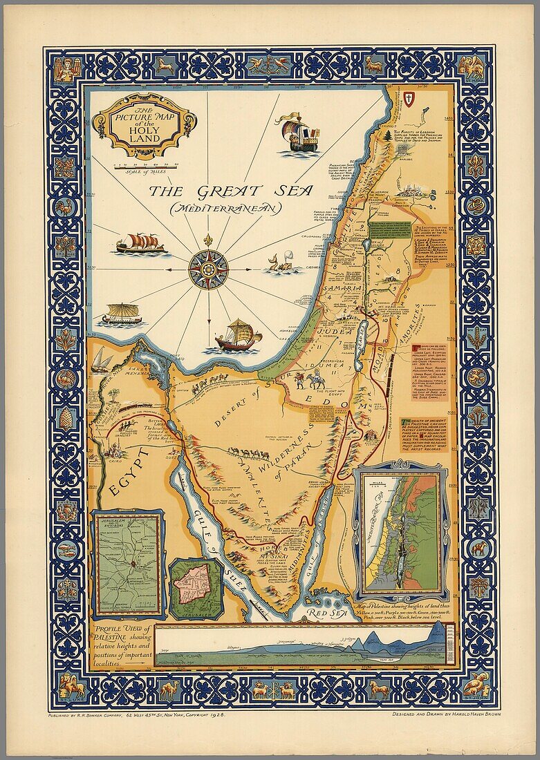
| Picture map of the Holy Land, published by R.R. Bowker Company in 1928. The map shows historical boundaries, roads, railway, and places named in the New Testament. It also shows Israel's route to the promised Land in Egypt to the River Jordan, routes used by all who travelled between Egypt and Palestine on the ancient caravan route from Cairo to Mecca. Includes key locations from the biblical narrative, views of sailing ships on The Great Sea (Mediterranean). | |
| Lizenzart: | Lizenzpflichtig |
| Credit: | Science Photo Library / Photostock-Israel |
| Bildgröße: | 3671 px × 5168 px |
| Modell-Rechte: | nicht erforderlich |
| Eigentums-Rechte: | nicht erforderlich |
| Restrictions: | - |
Preise für dieses Bild ab 15 €
Universitäten & Organisationen
(Informationsmaterial Digital, Informationsmaterial Print, Lehrmaterial Digital etc.)
ab 15 €
Redaktionell
(Bücher, Bücher: Sach- und Fachliteratur, Digitale Medien (redaktionell) etc.)
ab 30 €
Werbung
(Anzeigen, Aussenwerbung, Digitale Medien, Fernsehwerbung, Karten, Werbemittel, Zeitschriften etc.)
ab 55 €
Handelsprodukte
(bedruckte Textilie, Kalender, Postkarte, Grußkarte, Verpackung etc.)
ab 75 €
Pauschalpreise
Rechtepakete für die unbeschränkte Bildnutzung in Print oder Online
ab 495 €
Keywords
- 1900er Jahre,
- Ägypten,
- Bibel,
- Bild,
- Bildlich,
- dekorativ,
- Dekoriert,
- Eisenbahn,
- Farbe,
- Fluss,
- Gerahmt,
- Geschichte,
- Grenzen,
- heiliges Land,
- historisch,
- Illustration,
- Israel,
- Jordanien,
- Kairo,
- Karte,
- Kunstwerk,
- Linderung,
- Meer,
- Mittelmeer,
- neues Testament,
- Niemand,
- Palästina,
- Rahmen,
- Rand,
- Route,
- Routen,
- Schiff,
- Schiffe,
- Segeln,
- Unternehmen