Global maritime map, 16th century
Bildnummer 13435434
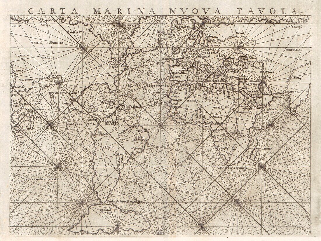
| 16th century global maritime map by Italian cartographer Giacomo Gastaldi (c.1500-1566) entitled 'Carta Marina Nuova Tavola'. The map shows the continents connected together, relying on the idea by mathematician Ptolemy (100-170 AD) of interconnected landmasses. Published in 1561. | |
| Lizenzart: | Lizenzpflichtig |
| Credit: | Science Photo Library / Library of Congress |
| Bildgröße: | 3500 px × 2627 px |
| Modell-Rechte: | nicht erforderlich |
| Eigentums-Rechte: | nicht erforderlich |
| Restrictions: | - |
Preise für dieses Bild ab 15 €
Universitäten & Organisationen
(Informationsmaterial Digital, Informationsmaterial Print, Lehrmaterial Digital etc.)
ab 15 €
Redaktionell
(Bücher, Bücher: Sach- und Fachliteratur, Digitale Medien (redaktionell) etc.)
ab 30 €
Werbung
(Anzeigen, Aussenwerbung, Digitale Medien, Fernsehwerbung, Karten, Werbemittel, Zeitschriften etc.)
ab 55 €
Handelsprodukte
(bedruckte Textilie, Kalender, Postkarte, Grußkarte, Verpackung etc.)
ab 75 €
Pauschalpreise
Rechtepakete für die unbeschränkte Bildnutzung in Print oder Online
ab 495 €