Cape Hatteras National Seashore, USA, satellite image
Bildnummer 13417423
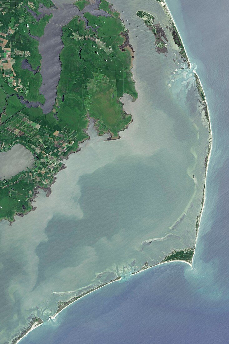
| Satellite image of Cape Hatteras National Seashore, USA. This national park preserves barrier islands that form a part of North Carolina's Outer Banks. The Outer Banks are simultaneously undergoing erosion and build-up of sand in other areas. At Cape Hatteras (right, pointed tip) the height and distance of sand dunes from the ocean has allowed forests to grow. The islands are exposed to hurricanes and nor'easters from the Atlantic Ocean. Image obtained by the Operational Land Imager (OLI) on the Landsat 8 satellite. | |
| Lizenzart: | Lizenzpflichtig |
| Credit: | Science Photo Library / NASA |
| Bildgröße: | 4784 px × 7176 px |
| Modell-Rechte: | nicht erforderlich |
| Eigentums-Rechte: | nicht erforderlich |
| Restrictions: | - |
Preise für dieses Bild ab 15 €
Universitäten & Organisationen
(Informationsmaterial Digital, Informationsmaterial Print, Lehrmaterial Digital etc.)
ab 15 €
Redaktionell
(Bücher, Bücher: Sach- und Fachliteratur, Digitale Medien (redaktionell) etc.)
ab 30 €
Werbung
(Anzeigen, Aussenwerbung, Digitale Medien, Fernsehwerbung, Karten, Werbemittel, Zeitschriften etc.)
ab 55 €
Handelsprodukte
(bedruckte Textilie, Kalender, Postkarte, Grußkarte, Verpackung etc.)
ab 75 €
Pauschalpreise
Rechtepakete für die unbeschränkte Bildnutzung in Print oder Online
ab 495 €