Landslides on Mars, satellite image
Bildnummer 13406151
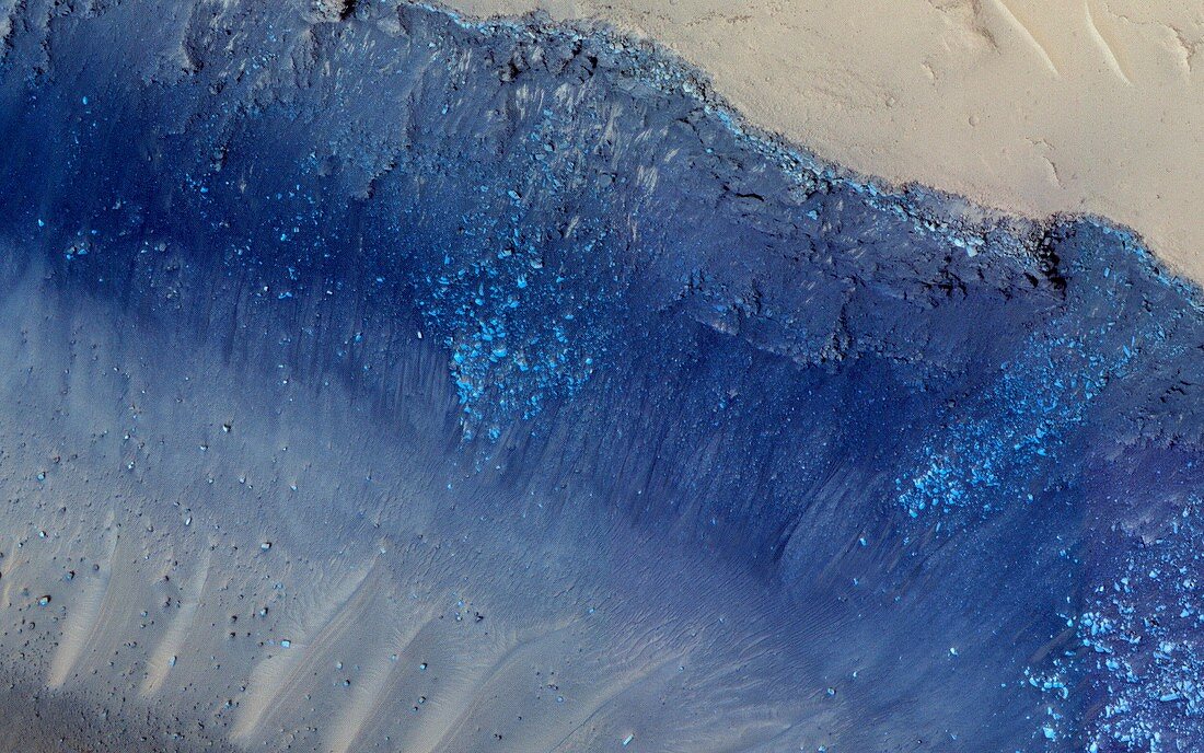
| Coloured satellite image of landslides on ground fissures in the Martian surface, known as the Cerberus Fossae. The light blue boulders on the slope appear to have fallen from a layer of bedrock at upper right. The Cerberus Fossae were formed when pressure from underground magma pulled the crust apart along fault lines. The process released large amounts of pressurised underground water and volcanic lava. The dark blue areas are basaltic rock and the lighter-coloured surface is sand. Imaged by the High Resolution Imaging Science Experiment (HiRISE) camera on NASA's Mars Reconnaissance Orbiter. | |
| Lizenzart: | Lizenzpflichtig |
| Credit: | Science Photo Library / NASA / JPL / University of Arizona |
| Bildgröße: | 3750 px × 2344 px |
| Modell-Rechte: | nicht erforderlich |
| Eigentums-Rechte: | nicht erforderlich |
| Restrictions: | - |
Preise für dieses Bild ab 15 €
Universitäten & Organisationen
(Informationsmaterial Digital, Informationsmaterial Print, Lehrmaterial Digital etc.)
ab 15 €
Redaktionell
(Bücher, Bücher: Sach- und Fachliteratur, Digitale Medien (redaktionell) etc.)
ab 30 €
Werbung
(Anzeigen, Aussenwerbung, Digitale Medien, Fernsehwerbung, Karten, Werbemittel, Zeitschriften etc.)
ab 55 €
Handelsprodukte
(bedruckte Textilie, Kalender, Postkarte, Grußkarte, Verpackung etc.)
ab 75 €
Pauschalpreise
Rechtepakete für die unbeschränkte Bildnutzung in Print oder Online
ab 495 €
Keywords
- 21. Jahrhundert,
- Astrogeologie,
- astrogeologisch,
- Astronomie,
- astronomisch,
- ausgesetzt,
- Basalt,
- Chlorid,
- Depression,
- Einlagen,
- Erdrutsch,
- Felsen,
- Felsig,
- Flut,
- Formation,
- Formationen,
- geografisch,
- Geographie,
- Geologie,
- geologisch,
- Kandidat,
- Landeplatz,
- laval,
- Mars,
- MRO,
- NASA,
- Oberfläche,
- Planetenwissenschaft,
- Raum,
- Riss,
- Risse,
- Salz,
- Satellitenbild,
- Schlucht,
- Tal,
- topografisch,
- Topographie,
- Trog,
- überflutet,
- vom Mars,
- vulkanisch,
- Weltall