Western Europe, satellite image
Bildnummer 13405744
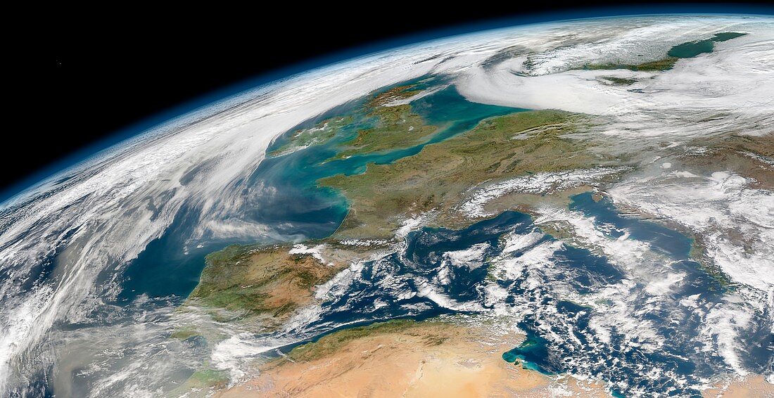
| Western Europe, satellite image. Tidal currents around the British Isles have stirred up bottom sediments, turning the water brown in places. Data obtained by the Moderate Resolution Imaging Spectroradiometer (MODIS) on NASAâ??s Aqua satellite on 11th February 2008. | |
| Lizenzart: | Lizenzpflichtig |
| Credit: | Science Photo Library / NASA Goddard Space Flight Center, Ocean Biology Processing Group |
| Bildgröße: | 7000 px × 3600 px |
| Modell-Rechte: | nicht erforderlich |
| Eigentums-Rechte: | nicht erforderlich |
| Restrictions: | - |
Preise für dieses Bild ab 15 €
Universitäten & Organisationen
(Informationsmaterial Digital, Informationsmaterial Print, Lehrmaterial Digital etc.)
ab 15 €
Redaktionell
(Bücher, Bücher: Sach- und Fachliteratur, Digitale Medien (redaktionell) etc.)
ab 30 €
Werbung
(Anzeigen, Aussenwerbung, Digitale Medien, Fernsehwerbung, Karten, Werbemittel, Zeitschriften etc.)
ab 55 €
Handelsprodukte
(bedruckte Textilie, Kalender, Postkarte, Grußkarte, Verpackung etc.)
ab 75 €
Pauschalpreise
Rechtepakete für die unbeschränkte Bildnutzung in Print oder Online
ab 495 €