Niepolomice Forest, Poland, satellite image
Bildnummer 13403702
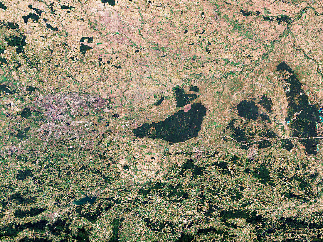
| Satellite image of the Niepolomice forest in Poland. The forest (dark green, centre) is surrounded by towns and farms and contains pockets of an old-growth deciduous forest that once covered the region. It is managed in small areas with different management strategies. These divisions are visible in the image, with sections of the forest that are a solid, untouched green, while others contain paler green clearings. Data obtained by the Operational Land Imager (OLI) on the NASA's Landsat 8 satellite. | |
| Lizenzart: | Lizenzpflichtig |
| Credit: | Science Photo Library / US Geological Survey / NASA Earth Observatory, Robert Simmon |
| Bildgröße: | 5179 px × 3886 px |
| Modell-Rechte: | nicht erforderlich |
| Eigentums-Rechte: | nicht erforderlich |
| Restrictions: | - |
Preise für dieses Bild ab 15 €
Universitäten & Organisationen
(Informationsmaterial Digital, Informationsmaterial Print, Lehrmaterial Digital etc.)
ab 15 €
Redaktionell
(Bücher, Bücher: Sach- und Fachliteratur, Digitale Medien (redaktionell) etc.)
ab 30 €
Werbung
(Anzeigen, Aussenwerbung, Digitale Medien, Fernsehwerbung, Karten, Werbemittel, Zeitschriften etc.)
ab 55 €
Handelsprodukte
(bedruckte Textilie, Kalender, Postkarte, Grußkarte, Verpackung etc.)
ab 75 €
Pauschalpreise
Rechtepakete für die unbeschränkte Bildnutzung in Print oder Online
ab 495 €