Lena river delta, satellite image
Bildnummer 13403686
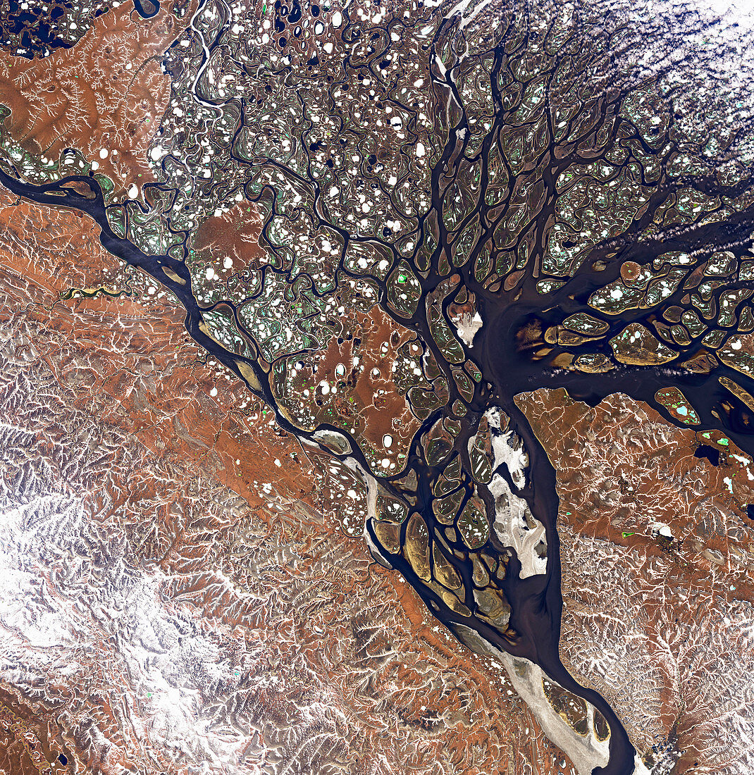
| Natural colour satellite image of the Lena river delta in Siberia. Some of the ponds appear green because they have a layer of melt water over a lower layer of ice. The Lena is one of three Siberian rivers that flow into the Arctic Ocean. It is 4, 294 kilometres long, and has a drainage basin of 2, 490, 000 square kilometres. Data obtained by the Operational Land Imager (OLI) on NASA's Landsat 8 satellite. | |
| Lizenzart: | Lizenzpflichtig |
| Credit: | Science Photo Library / US Geological Survey / NASA Earth Observatory, Joshua Stevens |
| Bildgröße: | 5831 px × 5994 px |
| Modell-Rechte: | nicht erforderlich |
| Eigentums-Rechte: | nicht erforderlich |
| Restrictions: | - |
Preise für dieses Bild ab 15 €
Universitäten & Organisationen
(Informationsmaterial Digital, Informationsmaterial Print, Lehrmaterial Digital etc.)
ab 15 €
Redaktionell
(Bücher, Bücher: Sach- und Fachliteratur, Digitale Medien (redaktionell) etc.)
ab 30 €
Werbung
(Anzeigen, Aussenwerbung, Digitale Medien, Fernsehwerbung, Karten, Werbemittel, Zeitschriften etc.)
ab 55 €
Handelsprodukte
(bedruckte Textilie, Kalender, Postkarte, Grußkarte, Verpackung etc.)
ab 75 €
Pauschalpreise
Rechtepakete für die unbeschränkte Bildnutzung in Print oder Online
ab 495 €