California wildfires, September 2020, Infrared image
Bildnummer 13355788
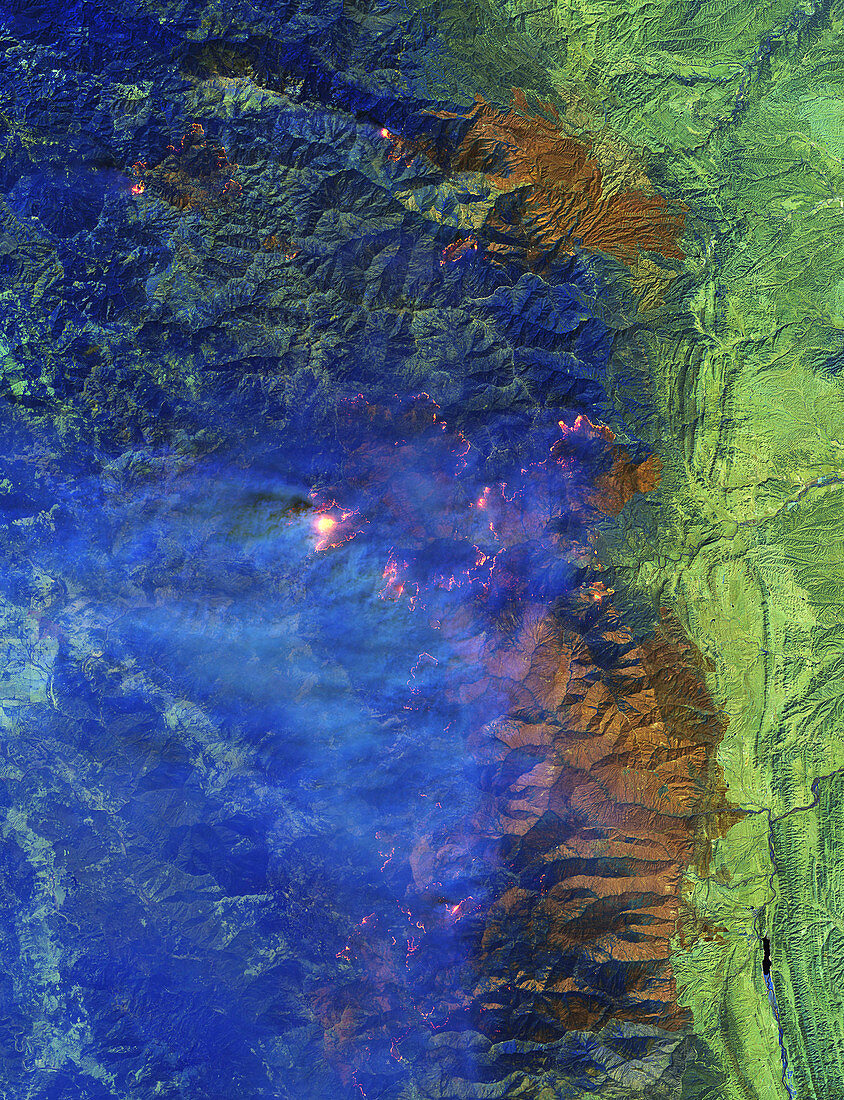
| Short-wave infrared (SWIR) satellite image of wildfires burning in the Mendocino National Forest, California, USA. Since mid-August millions of acres have burned on the US Pacific coast, destroying thousands of homes and killing dozens of people. Data obtained by the Operational Land Imager (OLI) on the Landsat 8 satellite on 1st September 2020. | |
| Lizenzart: | Lizenzpflichtig |
| Credit: | Science Photo Library / US GEOLOGICAL SURVEY / NASA EARTH OBSERVATORY, JOSHUA STEVENS |
| Bildgröße: | 2600 px × 3387 px |
| Modell-Rechte: | nicht erforderlich |
| Eigentums-Rechte: | nicht erforderlich |
| Restrictions: |
|
Preise für dieses Bild ab 15 €
Universitäten & Organisationen
(Informationsmaterial Digital, Informationsmaterial Print, Lehrmaterial Digital etc.)
ab 15 €
Redaktionell
(Bücher, Bücher: Sach- und Fachliteratur, Digitale Medien (redaktionell) etc.)
ab 30 €
Werbung
(Anzeigen, Aussenwerbung, Digitale Medien, Fernsehwerbung, Karten, Werbemittel, Zeitschriften etc.)
ab 55 €
Handelsprodukte
(bedruckte Textilie, Kalender, Postkarte, Grußkarte, Verpackung etc.)
ab 75 €
Pauschalpreise
Rechtepakete für die unbeschränkte Bildnutzung in Print oder Online
ab 495 €
Keywords
- 2000er Jahre,
- 21. Jahrhundert,
- Atmosphäre,
- atmosphärisch,
- Farbe,
- Feuer,
- Globale Erwärmung,
- infrarot,
- Kalifornien,
- Klimatologie,
- klimatologisch,
- Klimawandel,
- Kurzwelliges Infrarot,
- Landsat 8,
- Naturkatastrophe,
- Niemand,
- Nordamerika,
- nordamerikanisch,
- oli,
- Rauch,
- Satellitenbild,
- Umwelt,
- USA,
- Vereinigte Staaten,
- Verschmutzung,
- Weltall