Wildfire in Greenland in August 2017, satellite image
Bildnummer 12991477
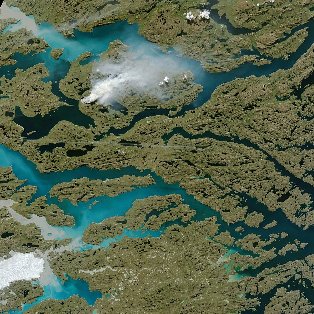
| Wildfire in Greenland in August 2017, satellite image. This sizable wildfire (smoke at upper left) burned along Greenland's coast in August 2017. The fire (which appears to be fuelled by peat) burned in western Greenland, about 150 kilometres north-east of Sisimiut. A dry summer made the vegetation here more prone to fires. Satellites first detected evidence of the fire on 31 July 2017. This image was obtained on 3 August 2017 by the Operational Land Imager (OLI) on the Landsat 8 satellite. | |
| Lizenzart: | Lizenzpflichtig |
| Credit: | Science Photo Library / NASA Earth Observatory |
| Bildgröße: | 5944 px × 5944 px |
| Modell-Rechte: | nicht erforderlich |
| Eigentums-Rechte: | nicht erforderlich |
| Restrictions: | - |
Preise für dieses Bild ab 15 €
Universitäten & Organisationen
(Informationsmaterial Digital, Informationsmaterial Print, Lehrmaterial Digital etc.)
ab 15 €
Redaktionell
(Bücher, Bücher: Sach- und Fachliteratur, Digitale Medien (redaktionell) etc.)
ab 30 €
Werbung
(Anzeigen, Aussenwerbung, Digitale Medien, Fernsehwerbung, Karten, Werbemittel, Zeitschriften etc.)
ab 55 €
Handelsprodukte
(bedruckte Textilie, Kalender, Postkarte, Grußkarte, Verpackung etc.)
ab 75 €
Pauschalpreise
Rechtepakete für die unbeschränkte Bildnutzung in Print oder Online
ab 495 €