Topographical map of Africa,satellite radar data
Bildnummer 12961542
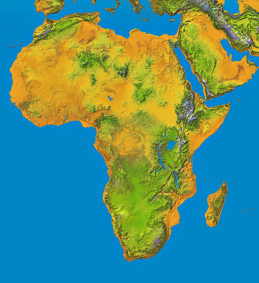
| Topographical map of Africa,satellite radar data. This map uses elevation data from NASA's Shuttle Radar Topography Mission (SRTM) in February 2000. In 2004,this data was released for the first time for most of the African continent,shown here as a colour-shaded relief map. The SRTM data was obtained using C-Band Interferometric Radar and X-Band Radar. Colour-coding is directly related to topographic height,with brown and yellow at the lower elevations,rising through green,to white at the highest elevations. Blue areas on the map represent water. | |
| Lizenzart: | Lizenzpflichtig |
| Credit: | Science Photo Library / NIMA / JPL / NASA |
| Bildgröße: | 5653 px × 6183 px |
| Modell-Rechte: | nicht erforderlich |
| Eigentums-Rechte: | nicht erforderlich |
| Restrictions: | - |
Preise für dieses Bild ab 15 €
Universitäten & Organisationen
(Informationsmaterial Digital, Informationsmaterial Print, Lehrmaterial Digital etc.)
ab 15 €
Redaktionell
(Bücher, Bücher: Sach- und Fachliteratur, Digitale Medien (redaktionell) etc.)
ab 30 €
Werbung
(Anzeigen, Aussenwerbung, Digitale Medien, Fernsehwerbung, Karten, Werbemittel, Zeitschriften etc.)
ab 55 €
Handelsprodukte
(bedruckte Textilie, Kalender, Postkarte, Grußkarte, Verpackung etc.)
ab 75 €
Pauschalpreise
Rechtepakete für die unbeschränkte Bildnutzung in Print oder Online
ab 495 €