Map of Guangdong and Hainan in China,17th century
Bildnummer 12960024
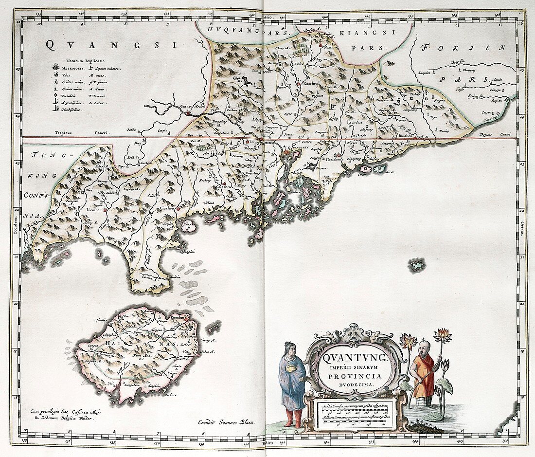
| Map of Guangdong and Hainan in China,17th century. The name of the imperial province is here given as 'Quantung'. The key at upper left indicates the size and type of settlements and military forts. The scale at lower right is in Chinese stadia and German miles. This map is from 'Novus atlas Sinensis' (1655) by Jesuit missionary and cartographer Martino Martini (1614-1661). This work was the most complete geographical description of China available to Europeans. | |
| Lizenzart: | Lizenzpflichtig |
| Credit: | Science Photo Library / Library of Congress,Geography and Map Division |
| Bildgröße: | 3509 px × 2995 px |
| Modell-Rechte: | nicht erforderlich |
| Eigentums-Rechte: | nicht erforderlich |
| Restrictions: | - |
Preise für dieses Bild ab 15 €
Universitäten & Organisationen
(Informationsmaterial Digital, Informationsmaterial Print, Lehrmaterial Digital etc.)
ab 15 €
Redaktionell
(Bücher, Bücher: Sach- und Fachliteratur, Digitale Medien (redaktionell) etc.)
ab 30 €
Werbung
(Anzeigen, Aussenwerbung, Digitale Medien, Fernsehwerbung, Karten, Werbemittel, Zeitschriften etc.)
ab 55 €
Handelsprodukte
(bedruckte Textilie, Kalender, Postkarte, Grußkarte, Verpackung etc.)
ab 75 €
Pauschalpreise
Rechtepakete für die unbeschränkte Bildnutzung in Print oder Online
ab 495 €