Map of the Maluku Islands,17th century
Bildnummer 12960023
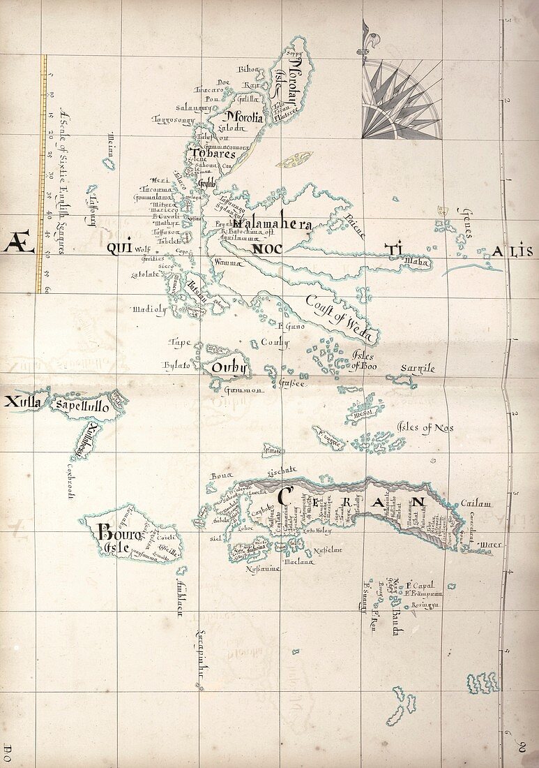
| Map of the Maluku Islands,17th century. These islands were commonly known as the Spice Islands or the Moluccas. The main islands are Seram,Buru,the Sula Islands,the Obi Islands,Halmahera and Morotai. The islands lie on the equator,which runs across upper centre,marked as 'aequinoctialis'. The scale at upper left is in English leagues. This map is from 'A description of the sea coasts [...] in the East Indies' (c.1690) by cartographer William Hacke. This 'buccanneer atlas' was produced by Hacke in association with notorious pirate Captain Bartholomew Sharpe following his various expeditions to the South Seas. It includes navigational distances and sounding information. | |
| Lizenzart: | Lizenzpflichtig |
| Credit: | Science Photo Library / Library of Congress,Geography and Map Division |
| Bildgröße: | 4295 px × 6111 px |
| Modell-Rechte: | nicht erforderlich |
| Eigentums-Rechte: | nicht erforderlich |
| Restrictions: | - |
Preise für dieses Bild ab 15 €
Universitäten & Organisationen
(Informationsmaterial Digital, Informationsmaterial Print, Lehrmaterial Digital etc.)
ab 15 €
Redaktionell
(Bücher, Bücher: Sach- und Fachliteratur, Digitale Medien (redaktionell) etc.)
ab 30 €
Werbung
(Anzeigen, Aussenwerbung, Digitale Medien, Fernsehwerbung, Karten, Werbemittel, Zeitschriften etc.)
ab 55 €
Handelsprodukte
(bedruckte Textilie, Kalender, Postkarte, Grußkarte, Verpackung etc.)
ab 75 €
Pauschalpreise
Rechtepakete für die unbeschränkte Bildnutzung in Print oder Online
ab 495 €