Fort Rammekens,17th century
Bildnummer 12960003
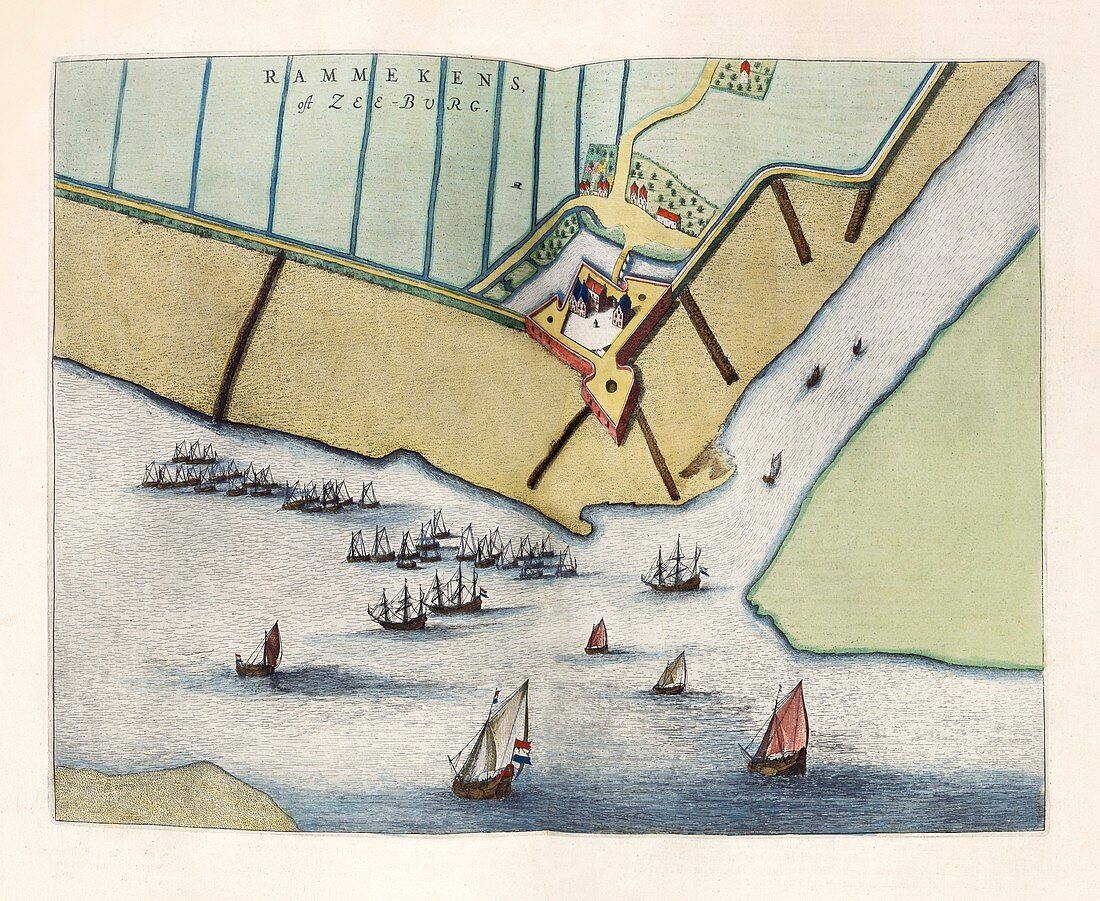
| Fort Rammekens,17th century. This fort is in the village of Ritthem,in the province of Zeeland,the Netherlands. The location overlooks the Westerschelde (the estuary of the Scheldt river). The fort dates from 1547,and was built to control the shipping routes to Middelburg and Antwerp. During the Dutch Golden Age that peaked in the 17th century,the Dutch had a strong standing field army with garrisons in the numerous fortified cities across the country. This map is from 'Toonneel der steden van de Vereenighde Nederlanden' (1652),an atlas of maps of the cities and towns of the United Provinces of the Netherlands,published by Dutch cartographer Joan Blau (1596-1673). | |
| Lizenzart: | Lizenzpflichtig |
| Credit: | Science Photo Library / Library of Congress,Geography and Map Division |
| Bildgröße: | 5546 px × 4545 px |
| Modell-Rechte: | nicht erforderlich |
| Eigentums-Rechte: | nicht erforderlich |
| Restrictions: | - |
Preise für dieses Bild ab 15 €
Universitäten & Organisationen
(Informationsmaterial Digital, Informationsmaterial Print, Lehrmaterial Digital etc.)
ab 15 €
Redaktionell
(Bücher, Bücher: Sach- und Fachliteratur, Digitale Medien (redaktionell) etc.)
ab 30 €
Werbung
(Anzeigen, Aussenwerbung, Digitale Medien, Fernsehwerbung, Karten, Werbemittel, Zeitschriften etc.)
ab 55 €
Handelsprodukte
(bedruckte Textilie, Kalender, Postkarte, Grußkarte, Verpackung etc.)
ab 75 €
Pauschalpreise
Rechtepakete für die unbeschränkte Bildnutzung in Print oder Online
ab 495 €