Map of Amsterdam,17th century
Bildnummer 12960001
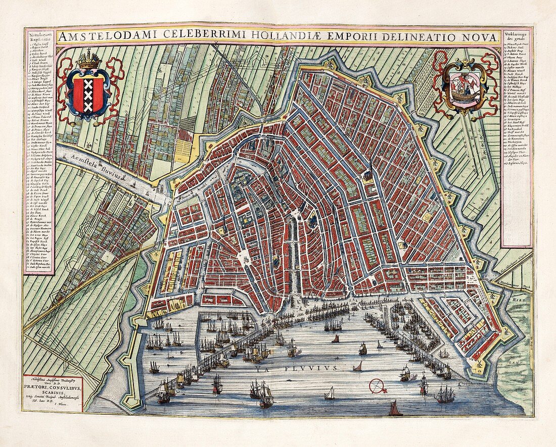
| Map of Amsterdam,17th century. This city is the capital of the Netherlands and a major port at the mouth of the Amstel River. The 17th century was the Golden Age of Amsterdam,when it was among the wealthiest cities in the world. The city coat-of-arms is at upper left. This map is from 'Toonneel der steden van de Vereenighde Nederlanden' (1652),an atlas of maps of the cities and towns of the United Provinces of the Netherlands,published by Dutch cartographer Joan Blau (1596-1673). | |
| Lizenzart: | Lizenzpflichtig |
| Credit: | Science Photo Library / Library of Congress,Geography and Map Division |
| Bildgröße: | 6135 px × 4938 px |
| Modell-Rechte: | nicht erforderlich |
| Eigentums-Rechte: | nicht erforderlich |
| Restrictions: | - |
Preise für dieses Bild ab 15 €
Universitäten & Organisationen
(Informationsmaterial Digital, Informationsmaterial Print, Lehrmaterial Digital etc.)
ab 15 €
Redaktionell
(Bücher, Bücher: Sach- und Fachliteratur, Digitale Medien (redaktionell) etc.)
ab 30 €
Werbung
(Anzeigen, Aussenwerbung, Digitale Medien, Fernsehwerbung, Karten, Werbemittel, Zeitschriften etc.)
ab 55 €
Handelsprodukte
(bedruckte Textilie, Kalender, Postkarte, Grußkarte, Verpackung etc.)
ab 75 €
Pauschalpreise
Rechtepakete für die unbeschränkte Bildnutzung in Print oder Online
ab 495 €