Deforestation in Bolivia, satellite image
Bildnummer 12950712
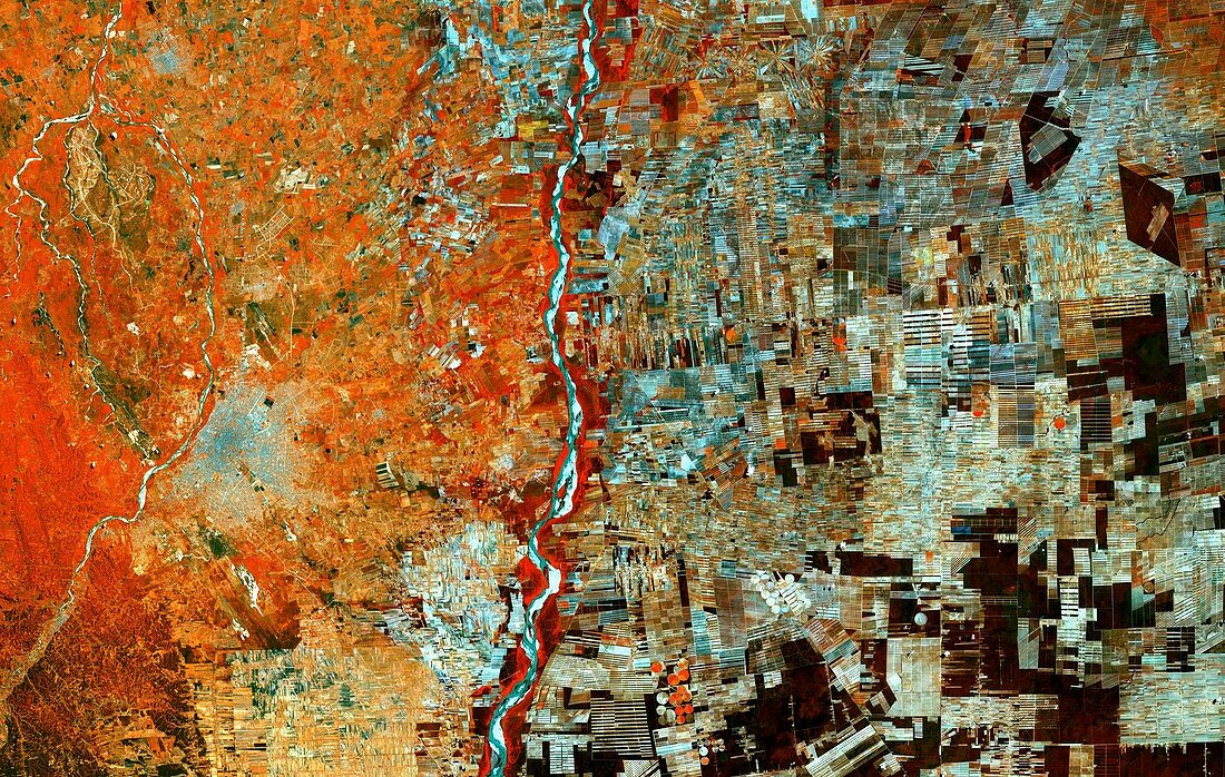
| Deforestation in Bolivia, satellite image. This area of Bolivia was once covered by trees but has now been cleared for resettlement schemes and agriculture. Bolivia's city of Santa Cruz is at lower left. Rapid deforestation has resulted in the region being transformed from dense forest into a large mosaic of fields. As well as countless rectangular fields, radial features can be seen where individual farmers have worked outwards from a central hub of communal land. Image data obtained on 30 September 2017, by the Copernicus Sentinel-2A satellite. | |
| Lizenzart: | Lizenzpflichtig |
| Credit: | Science Photo Library / Copernicus Sentinel data (2017) / EUROPEAN SPACE AGENCY |
| Bildgröße: | 9109 px × 5776 px |
| Modell-Rechte: | nicht erforderlich |
| Eigentums-Rechte: | nicht erforderlich |
| Restrictions: |
|
Preise für dieses Bild ab 15 €
Universitäten & Organisationen
(Informationsmaterial Digital, Informationsmaterial Print, Lehrmaterial Digital etc.)
ab 15 €
Redaktionell
(Bücher, Bücher: Sach- und Fachliteratur, Digitale Medien (redaktionell) etc.)
ab 30 €
Werbung
(Anzeigen, Aussenwerbung, Digitale Medien, Fernsehwerbung, Karten, Werbemittel, Zeitschriften etc.)
ab 55 €
Handelsprodukte
(bedruckte Textilie, Kalender, Postkarte, Grußkarte, Verpackung etc.)
ab 75 €
Pauschalpreise
Rechtepakete für die unbeschränkte Bildnutzung in Print oder Online
ab 495 €
Keywords
- 2017,
- 21. Jahrhundert,
- Abholzung,
- Bauernhof,
- Bodennutzung,
- Bolivianisch,
- Bolivien,
- copernicus,
- Erdbeobachtung,
- Feld,
- Felder,
- Feldfrüchte,
- geografisch,
- Geographie,
- Landwirtschaft,
- landwirtschaftlich,
- Lateinamerika,
- Niemand,
- Santa Cruz,
- Satellit,
- Satellitenbild,
- Stadt,
- Südamerika,
- Südamerikanisch,
- Weltall