Southern constellations, 18th century
Bildnummer 12949696
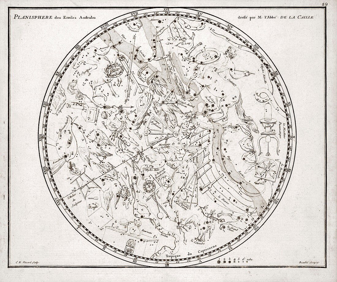
| Southern constellations. 18th-century map of constellations and stars of the southern celestial hemisphere. The constellations are represented by artworks of their mythical namesakes. At lower right is a key for the magnitude (brightness) of the stars. This map was by the French astronomer Nicolas Louis de Lacaille (1713-1762), who studied the southern sky from the Cape of Good Hope, South Africa, mapping some 10, 000 stars. This map appeared in both the 1776 and 1795 editions of Jean N. Fortin's 'Atlas Celeste de Flamsteed', a French edition of the posthumous 1729 atlas by British astronomer John Flamsteed (1646-1719). | |
| Lizenzart: | Lizenzpflichtig |
| Credit: | Science Photo Library / Library of Congress, Rare Book and Special Collections Division |
| Bildgröße: | 4590 px × 3839 px |
| Modell-Rechte: | nicht erforderlich |
| Eigentums-Rechte: | nicht erforderlich |
| Restrictions: | - |
Preise für dieses Bild ab 15 €
Universitäten & Organisationen
(Informationsmaterial Digital, Informationsmaterial Print, Lehrmaterial Digital etc.)
ab 15 €
Redaktionell
(Bücher, Bücher: Sach- und Fachliteratur, Digitale Medien (redaktionell) etc.)
ab 30 €
Werbung
(Anzeigen, Aussenwerbung, Digitale Medien, Fernsehwerbung, Karten, Werbemittel, Zeitschriften etc.)
ab 55 €
Handelsprodukte
(bedruckte Textilie, Kalender, Postkarte, Grußkarte, Verpackung etc.)
ab 75 €
Pauschalpreise
Rechtepakete für die unbeschränkte Bildnutzung in Print oder Online
ab 495 €
Keywords
- 1700er Jahre,
- 18. Jahrhundert,
- Astronomie,
- astronomisch,
- Atlas celeste de Flamsteed,
- Bildhauer,
- Blatt,
- Einfarbig,
- europäisch,
- Fernrohr,
- Fliege,
- Französisch,
- französischer Text,
- Geschichte,
- historisch,
- Illustration,
- John Flamsteed,
- Karte,
- Konstellation,
- Kunstwerk,
- Mythologie,
- Niemand,
- Pavo,
- Schlüssel,
- Schütze,
- Schwarz und weiß,
- Skorpion,
- Steinbock,
- Sternbilder,
- südlichen Hemisphäre,
- symbolisch,
- Tafelberg,
- Taube,
- Zahl