Land cover in and around the Amazon, 2018
Bildnummer 12949157
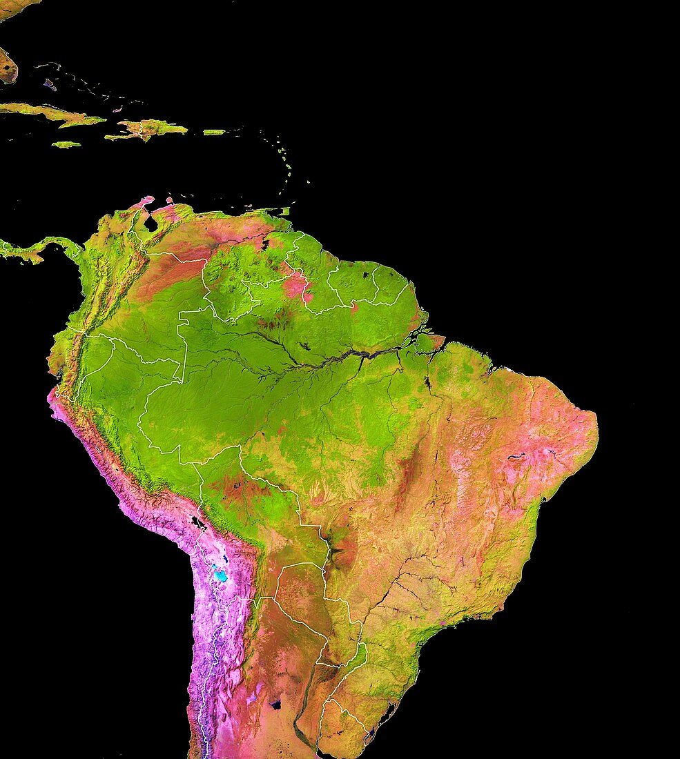
| Land cover in and around the Amazon, 2018. Colour-coded map based on satellite data, showing various land cover types in and around the Amazon rainforests. Dense vegetation and rainforest are dark green. Black areas are water. Orange areas are land cleared for pasture. Brown areas are flooded savanna and wetlands. Pink areas are bare ground. Purple areas are deserts and arid areas. Blue-white areas are salt flats. The map is based on images obtained by the Landsat 7 and Landsat 8 satellites. | |
| Lizenzart: | Lizenzpflichtig |
| Credit: | Science Photo Library / University of Maryland / USGS / NASA Earth Observatory |
| Bildgröße: | 4348 px × 4857 px |
| Modell-Rechte: | nicht erforderlich |
| Eigentums-Rechte: | nicht erforderlich |
| Restrictions: | - |
Preise für dieses Bild ab 15 €
Universitäten & Organisationen
(Informationsmaterial Digital, Informationsmaterial Print, Lehrmaterial Digital etc.)
ab 15 €
Redaktionell
(Bücher, Bücher: Sach- und Fachliteratur, Digitale Medien (redaktionell) etc.)
ab 30 €
Werbung
(Anzeigen, Aussenwerbung, Digitale Medien, Fernsehwerbung, Karten, Werbemittel, Zeitschriften etc.)
ab 55 €
Handelsprodukte
(bedruckte Textilie, Kalender, Postkarte, Grußkarte, Verpackung etc.)
ab 75 €
Pauschalpreise
Rechtepakete für die unbeschränkte Bildnutzung in Print oder Online
ab 495 €
Keywords
- 2018,
- 21. Jahrhundert,
- Abholzung,
- Art,
- Biom,
- Bolivien,
- Brasilien,
- Ecuador,
- Erdbeobachtung,
- farbcodiert,
- Felder,
- Feuchtgebiete,
- geografisch,
- Geographie,
- Karte,
- Kolumbien,
- Landsat 7,
- Landsat 8,
- Lateinamerika,
- Lebensraum,
- Lebensräume,
- Niemand,
- Ökologie,
- Ökologisch,
- Peru,
- Regenwald,
- Satellit,
- Satellitenbild,
- schwarzer Hintergrund,
- Südamerika,
- Suriname,
- Typen,
- Umweltwissenschaften,
- Vegetation,
- Venezuela,
- Weide,
- Weltall