Deforestation in the Amazon 1975 to 2012, satellite images
Bildnummer 12949156
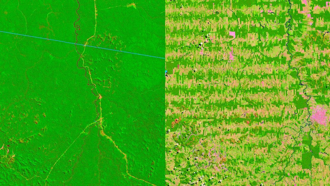
| Deforestation in the Amazon 1975 to 2012, satellite images. At left from 1975 is an area of rainforest in the Amazon, in the state of Rondonia in Brazil. The same area is shown at right 37 years later in 2012. Clearing of the forest for agricultural land has left a patchwork pattern that has fragmented the ecosystem. The images were obtained by Landsat satellites operated by NASA and the USGS. | |
| Lizenzart: | Lizenzpflichtig |
| Credit: | Science Photo Library / USGS / NASA's Goddard Space Flight Center |
| Bildgröße: | 4320 px × 2430 px |
| Modell-Rechte: | nicht erforderlich |
| Eigentums-Rechte: | nicht erforderlich |
| Restrictions: | - |
Preise für dieses Bild ab 15 €
Universitäten & Organisationen
(Informationsmaterial Digital, Informationsmaterial Print, Lehrmaterial Digital etc.)
ab 15 €
Redaktionell
(Bücher, Bücher: Sach- und Fachliteratur, Digitale Medien (redaktionell) etc.)
ab 30 €
Werbung
(Anzeigen, Aussenwerbung, Digitale Medien, Fernsehwerbung, Karten, Werbemittel, Zeitschriften etc.)
ab 55 €
Handelsprodukte
(bedruckte Textilie, Kalender, Postkarte, Grußkarte, Verpackung etc.)
ab 75 €
Pauschalpreise
Rechtepakete für die unbeschränkte Bildnutzung in Print oder Online
ab 495 €
Keywords
- 1900er Jahre,
- 20. Jahrhundert,
- 2012,
- 21. Jahrhundert,
- Abholzung,
- amazonisch,
- Brasilianer,
- Brasilien,
- Erdbeobachtung,
- geografisch,
- Geographie,
- Geschichte,
- historisch,
- Lateinamerika,
- Niemand,
- Reihenfolge,
- Rondonia,
- Satellitenbild,
- Schaden,
- Serie,
- Südamerika,
- Südamerikanisch,
- Tropen,
- Tropisch,
- Umweltwissenschaften,
- Vergleich,
- vergleichen,
- Wald,
- Weltall,
- Zerstörung