Map of London, 1798
Bildnummer 12902152
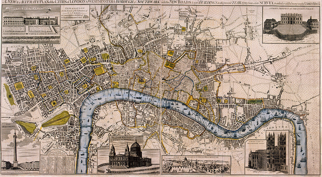
| Map of London, 1798. Map of the City of Westminster, City of London, River Thames, Lambeth, Southwark and surrounding areas, 1798. Top left view shows St James's Palace. Top right view shows Buckingham Palace. Along the lower section are views of the Monument, St Paul's Cathedral, River Thames and Westminster Abbey. | |
| Lizenzart: | Lizenzpflichtig |
| Credit: | Science Photo Library / Heritage Images / London Metropolitan Archives-City of London |
| Bildgröße: | 5624 px × 3102 px |
| Modell-Rechte: | nicht erforderlich |
| Eigentums-Rechte: | nicht erforderlich |
| Restrictions: | - |
Preise für dieses Bild ab 15 €
Universitäten & Organisationen
(Informationsmaterial Digital, Informationsmaterial Print, Lehrmaterial Digital etc.)
ab 15 €
Redaktionell
(Bücher, Bücher: Sach- und Fachliteratur, Digitale Medien (redaktionell) etc.)
ab 30 €
Werbung
(Anzeigen, Aussenwerbung, Digitale Medien, Fernsehwerbung, Karten, Werbemittel, Zeitschriften etc.)
ab 55 €
Handelsprodukte
(bedruckte Textilie, Kalender, Postkarte, Grußkarte, Verpackung etc.)
ab 75 €
Pauschalpreise
Rechtepakete für die unbeschränkte Bildnutzung in Print oder Online
ab 495 €
Keywords
- 1700er Jahre,
- 18. Jahrhundert,
- Abtei,
- achtzehntes Jahrhundert,
- Architektur,
- Blau,
- Buckingham Palace,
- Christentum,
- Dom,
- England,
- Englisch,
- Fluss,
- Gebäude,
- geografisch,
- Geographie,
- geographische Eigenschaft,
- Geschichte,
- Gravur,
- historisch,
- Illustration,
- Jahrhundert,
- Karte,
- Kunstwerk,
- London,
- Monument,
- Palast,
- Religion,
- religiös,
- Themse,
- Westminster Abbey