World land and sea floor topography
Bildnummer 12646041
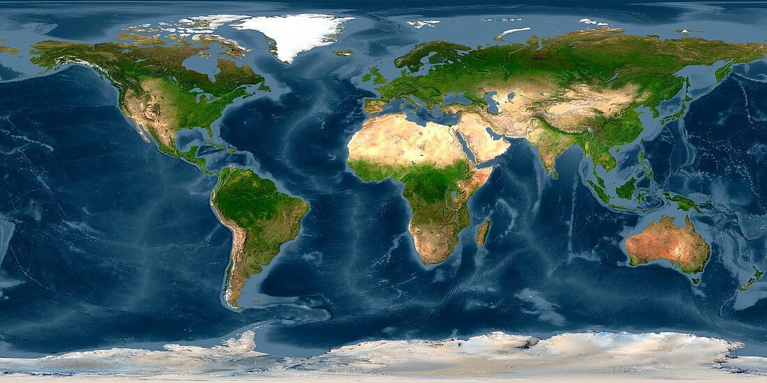
| World land and sea floor topography, cylindrical satellite map. The natural colours on land show deserts and vegetation, with mountains ranges also shown. Ocean depth is colour-coded, showing the relatively shallow continental shelves and the deep ocean plains and trenches. The bathymetry data combines satellite observations and ship surveys. The land imagery is from various satellites and digital maps. | |
| Lizenzart: | Lizenzpflichtig |
| Credit: | Science Photo Library / NOAA |
| Bildgröße: | 5914 px × 2957 px |
| Modell-Rechte: | nicht erforderlich |
| Eigentums-Rechte: | nicht erforderlich |
| Restrictions: |
|
Preise für dieses Bild ab 15 €
Universitäten & Organisationen
(Informationsmaterial Digital, Informationsmaterial Print, Lehrmaterial Digital etc.)
ab 15 €
Redaktionell
(Bücher, Bücher: Sach- und Fachliteratur, Digitale Medien (redaktionell) etc.)
ab 30 €
Werbung
(Anzeigen, Aussenwerbung, Digitale Medien, Fernsehwerbung, Karten, Werbemittel, Zeitschriften etc.)
ab 55 €
Handelsprodukte
(bedruckte Textilie, Kalender, Postkarte, Grußkarte, Verpackung etc.)
ab 75 €
Pauschalpreise
Rechtepakete für die unbeschränkte Bildnutzung in Print oder Online
ab 495 €
Keywords
- 21. Jahrhundert,
- Afrika,
- Antarktis,
- Arktis,
- Asien,
- Australien,
- Bathymetrie,
- bathymetrisch,
- Berge,
- Erdbeobachtung,
- Erde,
- Erdkunde,
- Eurasien,
- Europa,
- geografisch,
- Geographie,
- Geologie,
- geologisch,
- Kontinent,
- Kontinente,
- Land,
- Meer,
- Meeresboden,
- Meereskunde,
- Niemand,
- NOAA,
- Nordamerika,
- Ozean,
- Ozeane,
- Planet,
- planetarisch,
- Regale,
- Region,
- Reichweite,
- Satellit,
- Satellitenbild,
- Südamerika,
- topografisch,
- Topographie,
- Wasser,
- Welt,
- Weltall,
- weltweit