First World Ocean Floor Map, 1977, artwork
Bildnummer 12645808
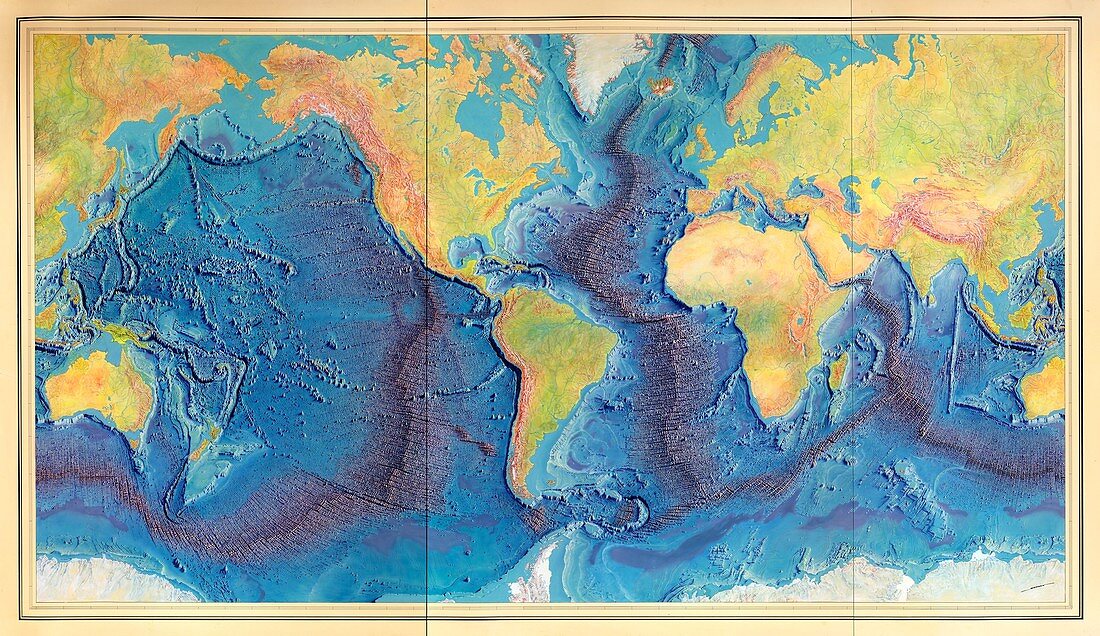
| 1977 World Ocean Floor Map created by Bruce Heezen and Marie Tharp. This was the first scientific map of the Atlantic Ocean floor. Tharp and Heezen's work revealed the presence of a continuous rift valley along the axis of the Mid-Atlantic Ridge, leading to acceptance of the theories of plate tectonics and continental drift. The map was hand-painted by the artist Heinrich Berann, based on sounding data painstakingly collected and mapped by Hezeen and Tharp. | |
| Lizenzart: | Lizenzpflichtig |
| Credit: | Science Photo Library / Library of Congress |
| Bildgröße: | 6048 px × 3495 px |
| Modell-Rechte: | nicht erforderlich |
| Eigentums-Rechte: | nicht erforderlich |
| Restrictions: | - |
Preise für dieses Bild ab 15 €
Universitäten & Organisationen
(Informationsmaterial Digital, Informationsmaterial Print, Lehrmaterial Digital etc.)
ab 15 €
Redaktionell
(Bücher, Bücher: Sach- und Fachliteratur, Digitale Medien (redaktionell) etc.)
ab 30 €
Werbung
(Anzeigen, Aussenwerbung, Digitale Medien, Fernsehwerbung, Karten, Werbemittel, Zeitschriften etc.)
ab 55 €
Handelsprodukte
(bedruckte Textilie, Kalender, Postkarte, Grußkarte, Verpackung etc.)
ab 75 €
Pauschalpreise
Rechtepakete für die unbeschränkte Bildnutzung in Print oder Online
ab 495 €
Keywords
- 1900er Jahre,
- 20. Jahrhundert,
- 3D,
- abgebildet,
- Atlantisch,
- Bathymetrie,
- bathymetrisch,
- Bett,
- Erde,
- erst,
- Frau,
- Ganze,
- Gemalt,
- geografisch,
- Geographie,
- Geologie,
- geologisch,
- Geschichte,
- Grat,
- Heinrich,
- historisch,
- Illustration,
- Karte,
- Kontinent,
- Kunstwerk,
- Linderung,
- Malerei,
- Marie,
- Marine,
- Meer,
- Meeresboden,
- Meereskunde,
- Niemand,
- Ozean,
- Projektion,
- Teller,
- topografisch,
- Topographie,
- topographisch,
- unter Wasser,
- untere,
- Unterwasser,
- Weiblich,
- Welt,
- weltweit,
- wissenschaftlich,
- Zeichnung