Historical map of the Battle of Salamis
Bildnummer 12642750
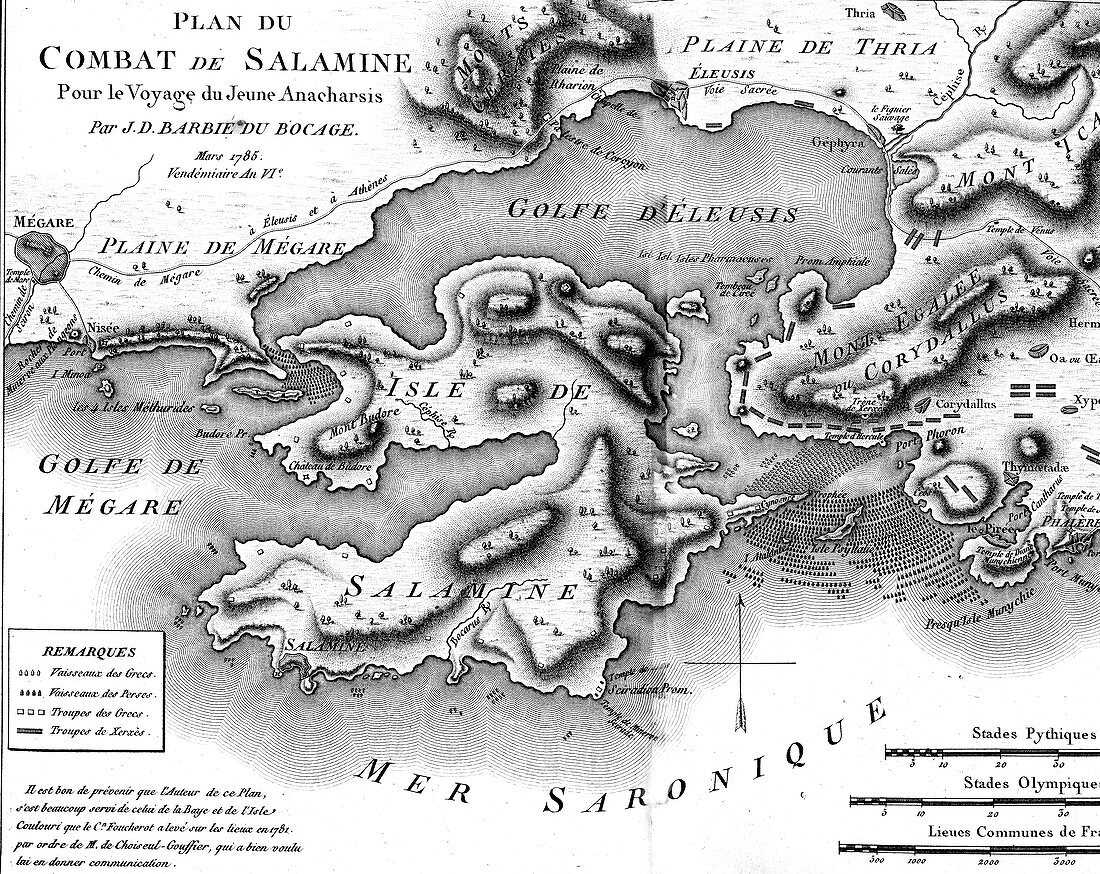
| Historical map of the Battle of Salamis. 18th-century illustration of a map from antiquity of the site of the naval Battle of Salamis on 29 September 480 BC between the Greeks and the Persian Empire, from the atlas by French cartographer Jean-Denis Barbie du Bocage (1760-1825) to accompany 'The Travels of Anacharsis the Younger in Greece' (1787) by French writer Jean-Jacques Barthelemy (1716-1795). This work, which the author pretend was by a grandson of a 6th-century-BC Scythian philosopher, was intended to popularise classical Greek history. Map engraved in the 1780s. | |
| Lizenzart: | Lizenzpflichtig |
| Credit: | Science Photo Library / Collection Abecasis |
| Bildgröße: | 3484 px × 2768 px |
| Modell-Rechte: | nicht erforderlich |
| Eigentums-Rechte: | nicht erforderlich |
| Restrictions: | - |
Preise für dieses Bild ab 15 €
Universitäten & Organisationen
(Informationsmaterial Digital, Informationsmaterial Print, Lehrmaterial Digital etc.)
ab 15 €
Redaktionell
(Bücher, Bücher: Sach- und Fachliteratur, Digitale Medien (redaktionell) etc.)
ab 30 €
Werbung
(Anzeigen, Aussenwerbung, Digitale Medien, Fernsehwerbung, Karten, Werbemittel, Zeitschriften etc.)
ab 55 €
Handelsprodukte
(bedruckte Textilie, Kalender, Postkarte, Grußkarte, Verpackung etc.)
ab 75 €
Pauschalpreise
Rechtepakete für die unbeschränkte Bildnutzung in Print oder Online
ab 495 €