Eruption of Fuego volcano, Guatemala, February 2018
Bildnummer 12582901
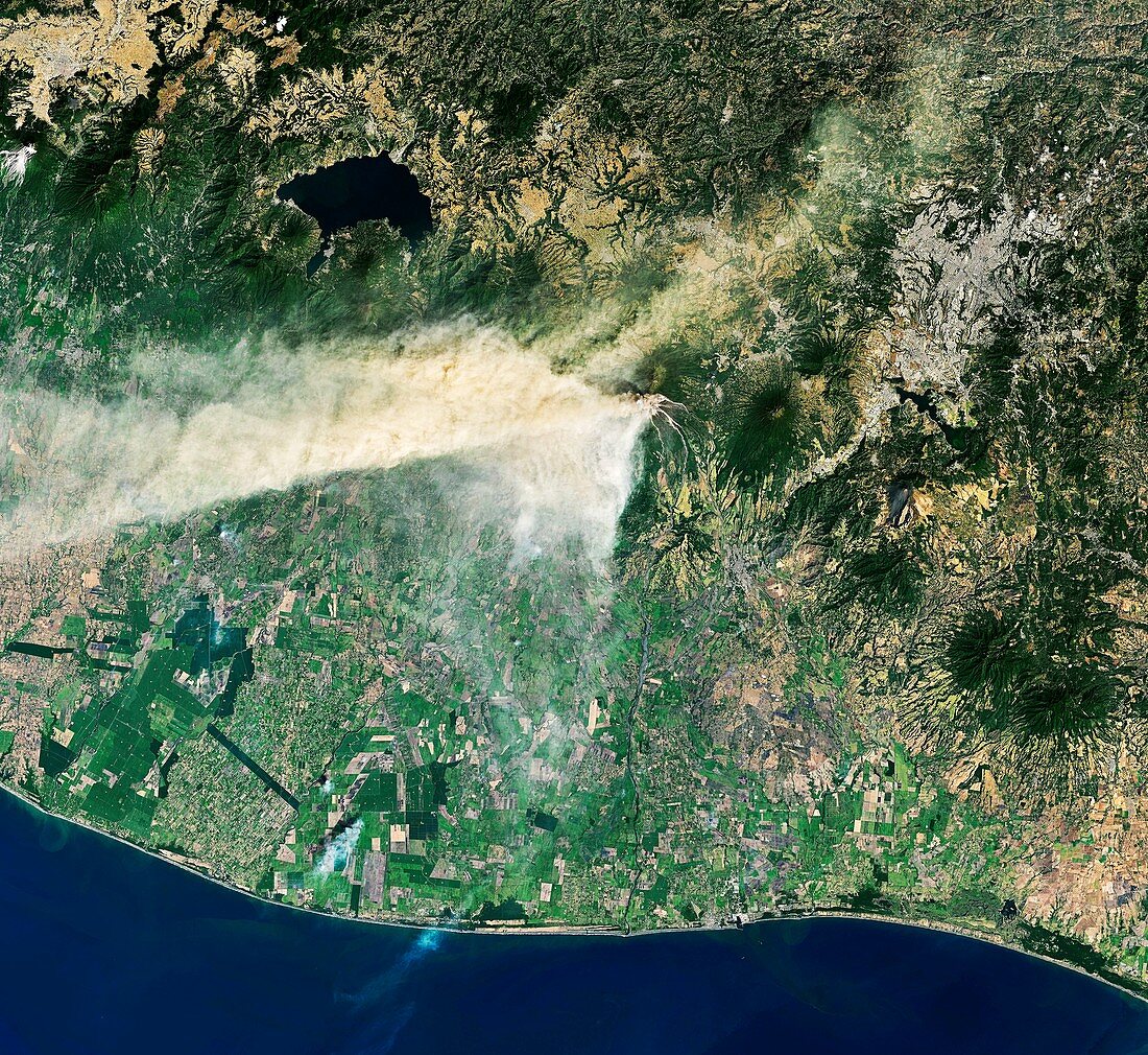
| Eruption of Fuego volcano. Satellite image of an eruption of the Volcan de Fuego (Volcano of Fire) in Guatemala. This eruption began on 31 January 2018. The plume reached an altitude of 6500 metres and was carried 40 kilometres to the west and south-west by the winds. Falling ash affected tens of thousands of people. Lava flows occurred along four ravines leading from the slopes of the volcano. Image data obtained on 1 February 2018 by the Operational Land Imager (OLI) on Landsat 8. | |
| Lizenzart: | Lizenzpflichtig |
| Credit: | Science Photo Library / Ges Disc / Usgs / Nasa Earth Observatory |
| Bildgröße: | 6177 px × 5669 px |
| Modell-Rechte: | nicht erforderlich |
| Eigentums-Rechte: | nicht erforderlich |
| Restrictions: | - |
Preise für dieses Bild ab 15 €
Universitäten & Organisationen
(Informationsmaterial Digital, Informationsmaterial Print, Lehrmaterial Digital etc.)
ab 15 €
Redaktionell
(Bücher, Bücher: Sach- und Fachliteratur, Digitale Medien (redaktionell) etc.)
ab 30 €
Werbung
(Anzeigen, Aussenwerbung, Digitale Medien, Fernsehwerbung, Karten, Werbemittel, Zeitschriften etc.)
ab 55 €
Handelsprodukte
(bedruckte Textilie, Kalender, Postkarte, Grußkarte, Verpackung etc.)
ab 75 €
Pauschalpreise
Rechtepakete für die unbeschränkte Bildnutzung in Print oder Online
ab 495 €