Sentinel-2 satellite in orbit, artwork
Bildnummer 12540270
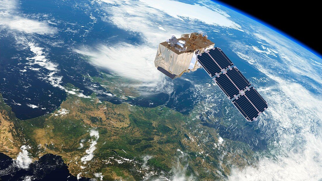
| Sentinel-2 satellite in orbit, artwork. The Sentinel-2 mission is part of the Copernicus programme, formerly Global Monitoring for Environment and Security (GMES). It consists of two identical satellites simultaneously orbiting the earth and providing continuous imagery of all Earth's land surfaces. Each satellite carries a single multi-spectral instrument (MSI) with 13 spectral channels in the visible/near infrared (VNIR) and short wave infrared spectral range (SWIR). Sentinel-2A was launched 23rd June 2015 and Sentinel-2B on 7 March 2017. They are used to image land cover for environmental and agriculture monitoring, glacier monitoring, and flood mapping and management. | |
| Lizenzart: | Lizenzpflichtig |
| Credit: | Science Photo Library / ESA / ATG Medialab |
| Bildgröße: | 5001 px × 2814 px |
| Modell-Rechte: | nicht erforderlich |
| Eigentums-Rechte: | nicht erforderlich |
| Restrictions: |
|
Preise für dieses Bild ab 15 €
Universitäten & Organisationen
(Informationsmaterial Digital, Informationsmaterial Print, Lehrmaterial Digital etc.)
ab 15 €
Redaktionell
(Bücher, Bücher: Sach- und Fachliteratur, Digitale Medien (redaktionell) etc.)
ab 30 €
Werbung
(Anzeigen, Aussenwerbung, Digitale Medien, Fernsehwerbung, Karten, Werbemittel, Zeitschriften etc.)
ab 55 €
Handelsprodukte
(bedruckte Textilie, Kalender, Postkarte, Grußkarte, Verpackung etc.)
ab 75 €
Pauschalpreise
Rechtepakete für die unbeschränkte Bildnutzung in Print oder Online
ab 495 €
Keywords
- 21. Jahrhundert,
- copernicus,
- Erdbeobachtung,
- Erde,
- esa,
- Europäische Weltraumbehörde,
- gmes,
- Illustration,
- Ingenieurwesen,
- Instrument,
- Klima,
- Klimatologie,
- klimatologisch,
- Kunstwerk,
- Land,
- Meteorologie,
- meteorologisch,
- Mission,
- Multispektral,
- Nah-Infrarot,
- Niemand,
- Oberfläche,
- Observation,
- Orbit,
- Raum,
- Raumschiff,
- Satellit,
- Sichtbar,
- Struktur,
- Technologie,
- technologisch,
- Überwachung,
- umkreisend,
- Umwelt,
- Veränderung,
- Weltraumflug,
- Wetter,
- Wissenschaft