Okavango River, Namibia and Angola, satellite image
Bildnummer 12540242
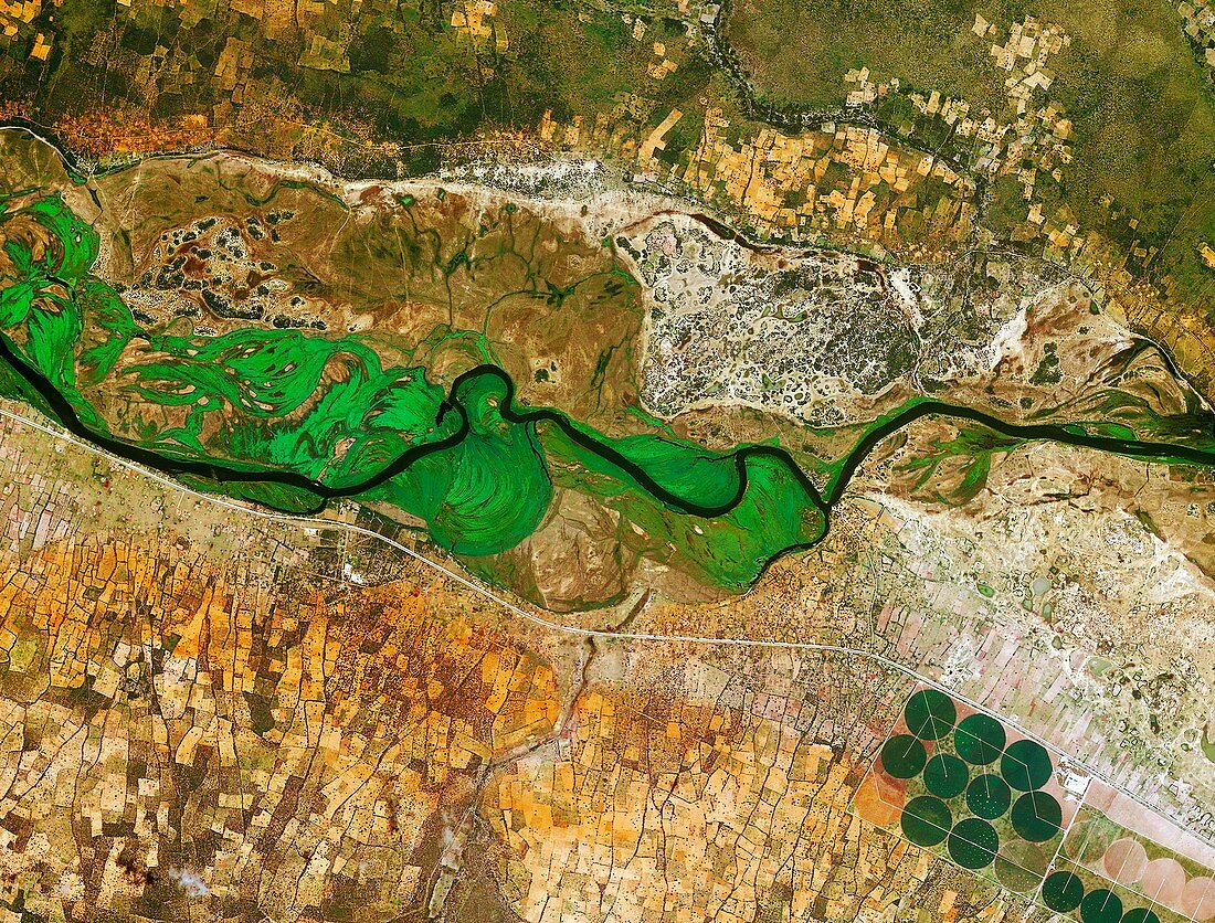
| Okavango River, Namibia and Angola, satellite image. The Okavango River runs across the image, and forms the border between Namibia to the south and Angola to the north. In the lower-right corner are circular agricultural plots. Image acquired by the Korea Multi-purpose Satellite (Kompsat-2) on 3 January 2013. | |
| Lizenzart: | Lizenzpflichtig |
| Credit: | Science Photo Library / KARI / ESA |
| Bildgröße: | 3668 px × 2788 px |
| Modell-Rechte: | nicht erforderlich |
| Eigentums-Rechte: | nicht erforderlich |
| Restrictions: |
|
Preise für dieses Bild ab 15 €
Universitäten & Organisationen
(Informationsmaterial Digital, Informationsmaterial Print, Lehrmaterial Digital etc.)
ab 15 €
Redaktionell
(Bücher, Bücher: Sach- und Fachliteratur, Digitale Medien (redaktionell) etc.)
ab 30 €
Werbung
(Anzeigen, Aussenwerbung, Digitale Medien, Fernsehwerbung, Karten, Werbemittel, Zeitschriften etc.)
ab 55 €
Handelsprodukte
(bedruckte Textilie, Kalender, Postkarte, Grußkarte, Verpackung etc.)
ab 75 €
Pauschalpreise
Rechtepakete für die unbeschränkte Bildnutzung in Print oder Online
ab 495 €
Keywords
- 2013,
- 21. Jahrhundert,
- Ackerland,
- Afrika,
- Afrikanisch,
- Angola,
- Bauernhof,
- Bewässerung,
- Bodennutzung,
- Center,
- Erdbeobachtung,
- Fluss,
- Fruchtbar,
- geografisch,
- Geographie,
- Grün,
- International,
- KOMPSAT-2,
- Kreis,
- Kreise,
- kreisförmig,
- Landwirtschaft,
- Namibia,
- namibisch,
- Rand,
- rund,
- Satellit,
- Satellitenbild,
- Vegetation,
- Wasser,
- Wasserweg,
- Weltall,
- Zentrum