Darfur, Sudan, satellite image
Bildnummer 12540234
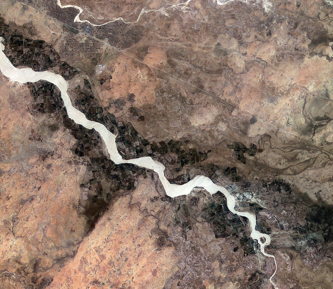
| Darfur, Sudan, satellite image. This image shows an area in the southern Darfur region of Sudan, just south of the city of Nyala. The Wadi Nyala flows diagonally across the image, surrounded by agricultural plots. To the north is the straight line of the railway. In the upper-left section are the numerous small structures of the Kalma camp, housing thousands of internally displaced people fleeing the conflict between Sudanese government forces and the indigenous population. Image acquired by Korea's Kompsat-2 satellite on 8 February 2013. | |
| Lizenzart: | Lizenzpflichtig |
| Credit: | Science Photo Library / KARI / ESA |
| Bildgröße: | 2941 px × 2552 px |
| Modell-Rechte: | nicht erforderlich |
| Eigentums-Rechte: | nicht erforderlich |
| Restrictions: |
|
Preise für dieses Bild ab 15 €
Universitäten & Organisationen
(Informationsmaterial Digital, Informationsmaterial Print, Lehrmaterial Digital etc.)
ab 15 €
Redaktionell
(Bücher, Bücher: Sach- und Fachliteratur, Digitale Medien (redaktionell) etc.)
ab 30 €
Werbung
(Anzeigen, Aussenwerbung, Digitale Medien, Fernsehwerbung, Karten, Werbemittel, Zeitschriften etc.)
ab 55 €
Handelsprodukte
(bedruckte Textilie, Kalender, Postkarte, Grußkarte, Verpackung etc.)
ab 75 €
Pauschalpreise
Rechtepakete für die unbeschränkte Bildnutzung in Print oder Online
ab 495 €