Earthquake ground displacement, Italy, August 2016
Bildnummer 12540226
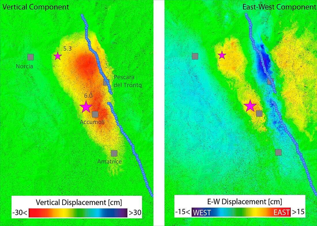
| Ground displacement due to earthquake, Italy. Satellite radar map of the region of central Italy struck by an earthquake on 24th August 2016 . Scientists from Italy's Institute for Electromagnetic Sensing of the Environment combined Sentinel-1 radar acquisitions over central Italy from before and after the earthquake: 15 August, 21 August and 27 August 2016. The result shows vertical ground subsidence, reaching about 20 centimetres in correspondence to the Accumoli area, and lateral movement of up to 16 centimetres. The blue line indicates the location of the fault trace. | |
| Lizenzart: | Lizenzpflichtig |
| Credit: | Science Photo Library / CNR-IREA / ESA |
| Bildgröße: | 3961 px × 2827 px |
| Modell-Rechte: | nicht erforderlich |
| Eigentums-Rechte: | nicht erforderlich |
| Restrictions: |
|
Preise für dieses Bild ab 15 €
Universitäten & Organisationen
(Informationsmaterial Digital, Informationsmaterial Print, Lehrmaterial Digital etc.)
ab 15 €
Redaktionell
(Bücher, Bücher: Sach- und Fachliteratur, Digitale Medien (redaktionell) etc.)
ab 30 €
Werbung
(Anzeigen, Aussenwerbung, Digitale Medien, Fernsehwerbung, Karten, Werbemittel, Zeitschriften etc.)
ab 55 €
Handelsprodukte
(bedruckte Textilie, Kalender, Postkarte, Grußkarte, Verpackung etc.)
ab 75 €
Pauschalpreise
Rechtepakete für die unbeschränkte Bildnutzung in Print oder Online
ab 495 €