Smartphones with Galileo GPS satnav
Bildnummer 12540223
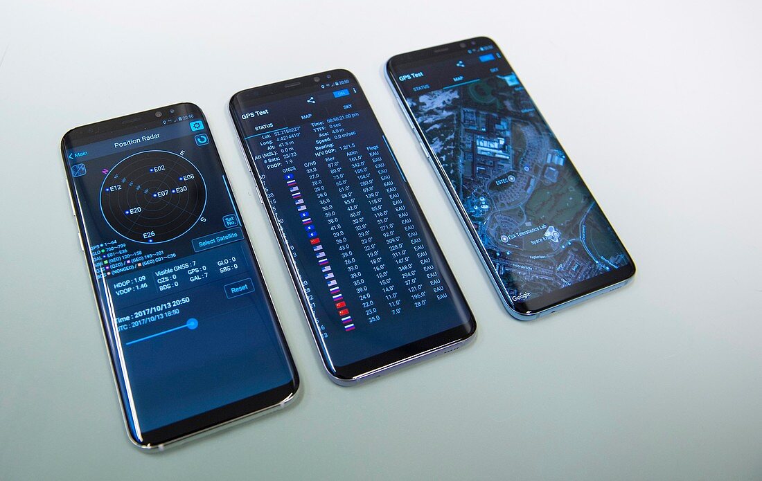
| Europe's Galileo satellite navigation system accessed via smartphones. Galileo is a civilian global positioning system (GPS) consisting of multiple satellites orbiting over 23, 000 kilometres above the Earth. The satellites transmit data for position (latitude and longitude) and elevation (height above sea level). Applications include car, train and aircraft guidance, rescue services, and road use taxation. | |
| Lizenzart: | Lizenzpflichtig |
| Credit: | Science Photo Library / G. Porter / ESA |
| Bildgröße: | 3938 px × 2488 px |
| Modell-Rechte: | nicht erforderlich |
| Eigentums-Rechte: | nicht erforderlich |
| Restrictions: |
|
Preise für dieses Bild ab 15 €
Universitäten & Organisationen
(Informationsmaterial Digital, Informationsmaterial Print, Lehrmaterial Digital etc.)
ab 15 €
Redaktionell
(Bücher, Bücher: Sach- und Fachliteratur, Digitale Medien (redaktionell) etc.)
ab 30 €
Werbung
(Anzeigen, Aussenwerbung, Digitale Medien, Fernsehwerbung, Karten, Werbemittel, Zeitschriften etc.)
ab 55 €
Handelsprodukte
(bedruckte Textilie, Kalender, Postkarte, Grußkarte, Verpackung etc.)
ab 75 €
Pauschalpreise
Rechtepakete für die unbeschränkte Bildnutzung in Print oder Online
ab 495 €
Keywords
- 21. Jahrhundert,
- 3D,
- Anruf,
- Anschluss,
- Anwendung,
- Anzeige,
- Berühren,
- Bildschirm,
- cgi,
- clever,
- Daten,
- Design,
- Digital,
- digital generiert,
- elektronisch,
- Erde,
- esa,
- Europa,
- europäisch,
- Gerät,
- Handy,
- Hintergrund,
- Illustration,
- Internet,
- isoliert,
- Karte,
- Kommunikation,
- kommunizieren,
- Konzept,
- Kunst,
- Kunstwerk,
- Mobilität,
- Mobiltelefon,
- Multimedia,
- Navigation,
- Netzwerk,
- Neu,
- Objekt,
- Satellit,
- Sinn,
- Smartphone,
- Suche,
- Symbol,
- taktil,
- Technologie,
- technologisch,
- Telefon,
- Telekommunikation,
- Übermittlung,
- Verbindung,
- Zugriff