Moon's surface and topography, LRO images
Bildnummer 12539230
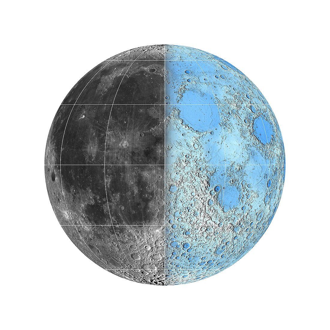
| Moon's surface and topography, LRO images. Lunar hemisphere, showing image data (left) and topographic data (right) from NASA's Lunar Reconnaissance Orbiter (LRO), which has been orbiting the Moon since 2009. The image at left was obtained by the Wide Angle Camera (WAC), while the image at right was obtained by the Lunar Orbiter Laser Altimeter (LOLA). The colour-coded image at right is from a dataset showing elevations ranging from plus 10, 000 to minus 9000 metres elevation. Images published in 2015. | |
| Lizenzart: | Lizenzpflichtig |
| Credit: | Science Photo Library / ARIZONA STATE UNIVERSITY / NASA / US GEOLOGICAL SURVEY |
| Bildgröße: | 3000 px × 3000 px |
| Modell-Rechte: | nicht erforderlich |
| Eigentums-Rechte: | nicht erforderlich |
| Restrictions: | - |
Preise für dieses Bild ab 15 €
Universitäten & Organisationen
(Informationsmaterial Digital, Informationsmaterial Print, Lehrmaterial Digital etc.)
ab 15 €
Redaktionell
(Bücher, Bücher: Sach- und Fachliteratur, Digitale Medien (redaktionell) etc.)
ab 30 €
Werbung
(Anzeigen, Aussenwerbung, Digitale Medien, Fernsehwerbung, Karten, Werbemittel, Zeitschriften etc.)
ab 55 €
Handelsprodukte
(bedruckte Textilie, Kalender, Postkarte, Grußkarte, Verpackung etc.)
ab 75 €
Pauschalpreise
Rechtepakete für die unbeschränkte Bildnutzung in Print oder Online
ab 495 €
Keywords
- 2015,
- 21. Jahrhundert,
- Astronomie,
- astronomisch,
- Astrophysik,
- astrophysikalisch,
- ausgeschnitten,
- Ausschnitte,
- Ball,
- Bild,
- farbcodiert,
- Globus,
- Karte,
- Kreis,
- kreisförmig,
- Kugel,
- kugelförmig,
- Lola,
- LRO,
- Mond,
- Mond-,
- NASA,
- Niemand,
- optisch,
- Planetenwissenschaft,
- Projektion,
- Raum,
- Satellit,
- Satellitenbild,
- Sonnensystem,
- topografisch,
- Topographie,
- usgs,
- weißer Hintergrund,
- Weltall