Hurricane Irma, satellite image
Bildnummer 12395099
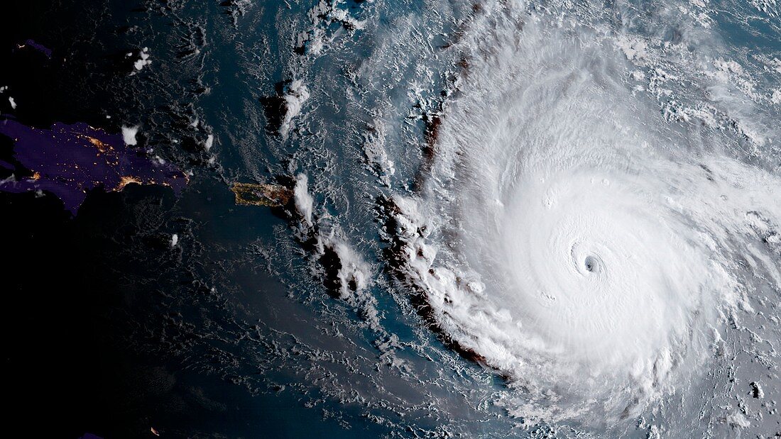
| Satellite image of Hurricane Irma as it approached the Leeward Islands on the 5th September 2017. Irma made landfall on the Leeward Islands as a category 5 storm with sustained winds of 295 kilometres per hour in the early morning of the 6th September. First hit was Barbuda, where over 90% of buildings were destroyed. Significant damage and loss of life were reported on the other Leeward Islands as Irma continued northwards. Data obtained by the Geostationary Operational Environmental Satellite (GOES) 16. | |
| Lizenzart: | Lizenzpflichtig |
| Credit: | Science Photo Library / CIRA / NOAA |
| Bildgröße: | 3900 px × 2194 px |
| Modell-Rechte: | nicht erforderlich |
| Eigentums-Rechte: | nicht erforderlich |
| Restrictions: |
|
Preise für dieses Bild ab 15 €
Universitäten & Organisationen
(Informationsmaterial Digital, Informationsmaterial Print, Lehrmaterial Digital etc.)
ab 15 €
Redaktionell
(Bücher, Bücher: Sach- und Fachliteratur, Digitale Medien (redaktionell) etc.)
ab 30 €
Werbung
(Anzeigen, Aussenwerbung, Digitale Medien, Fernsehwerbung, Karten, Werbemittel, Zeitschriften etc.)
ab 55 €
Handelsprodukte
(bedruckte Textilie, Kalender, Postkarte, Grußkarte, Verpackung etc.)
ab 75 €
Pauschalpreise
Rechtepakete für die unbeschränkte Bildnutzung in Print oder Online
ab 495 €