Rome, satellite image
Bildnummer 12378782
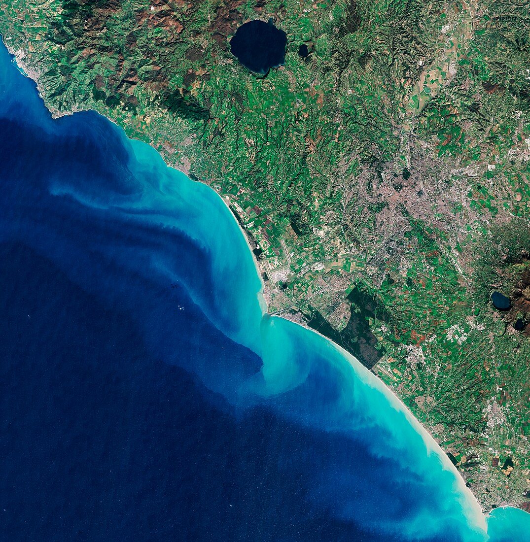
| Rome. Satellite image of the coastline and country surrounding the city of Rome, Italy. North is at top. Rome is at upper right (grey and brown). The Tiber River runs from upper right, surrounded by agricultural fields before entering the city. It then runs west and enters the Mediterranean Sea at the town of Ostia. Fiumicino Airport (centre) is just north of Ostia. Long, sandy beaches are visible along the coastline. The large lake at left of top centre is Bracciano. Image data obtained on 17 January 2016, by the Copernicus Sentinel-2A satellite. | |
| Lizenzart: | Lizenzpflichtig |
| Credit: | Science Photo Library / Copernicus Sentinel data (2016) / EUROPEAN SPACE AGENCY |
| Bildgröße: | 8343 px × 8535 px |
| Modell-Rechte: | nicht erforderlich |
| Eigentums-Rechte: | nicht erforderlich |
| Restrictions: |
|
Preise für dieses Bild ab 15 €
Universitäten & Organisationen
(Informationsmaterial Digital, Informationsmaterial Print, Lehrmaterial Digital etc.)
ab 15 €
Redaktionell
(Bücher, Bücher: Sach- und Fachliteratur, Digitale Medien (redaktionell) etc.)
ab 30 €
Werbung
(Anzeigen, Aussenwerbung, Digitale Medien, Fernsehwerbung, Karten, Werbemittel, Zeitschriften etc.)
ab 55 €
Handelsprodukte
(bedruckte Textilie, Kalender, Postkarte, Grußkarte, Verpackung etc.)
ab 75 €
Pauschalpreise
Rechtepakete für die unbeschränkte Bildnutzung in Print oder Online
ab 495 €
Keywords
- 2016,
- 21. Jahrhundert,
- Ackerland,
- Bauernhöfe,
- Bracciano,
- copernicus,
- Erdbeobachtung,
- Europa,
- europäisch,
- Felder,
- Flughafen,
- Fluss,
- geografisch,
- Geographie,
- Hügel,
- Italien,
- Italienisch,
- Küste,
- Küsten-,
- Küstenlinie,
- Land,
- Meer,
- Mittelmeer,
- Niemand,
- Rom,
- Satellit,
- Satellitenbild,
- See,
- Seen,
- Stadt,
- städtisch,
- Wasser,
- Weltall