Global maritime map, 1560s
Bildnummer 12362436
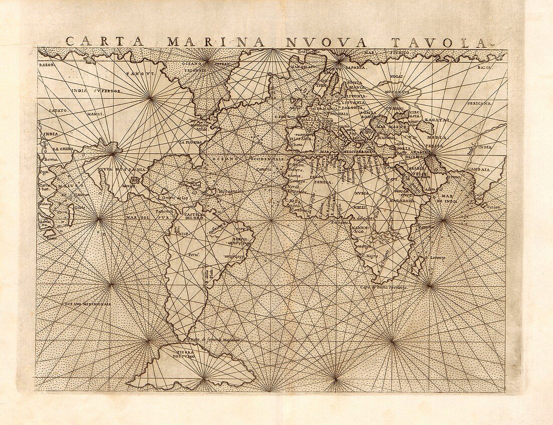
| Global maritime map, 1560s. 16th-century map of the world with portolan rhumb lines that aid navigation. This map is titled in Italian: Carta marina nuova tavola. It was created by Italian cartographer Giacomo Gastaldi (c.1500-1566) and published in around 1561. | |
| Lizenzart: | Lizenzpflichtig |
| Credit: | Science Photo Library / LIBRARY OF CONGRESS, Geography and Map Division |
| Bildgröße: | 3380 px × 2597 px |
| Modell-Rechte: | nicht erforderlich |
| Eigentums-Rechte: | nicht erforderlich |
| Restrictions: | - |
Preise für dieses Bild ab 15 €
Universitäten & Organisationen
(Informationsmaterial Digital, Informationsmaterial Print, Lehrmaterial Digital etc.)
ab 15 €
Redaktionell
(Bücher, Bücher: Sach- und Fachliteratur, Digitale Medien (redaktionell) etc.)
ab 30 €
Werbung
(Anzeigen, Aussenwerbung, Digitale Medien, Fernsehwerbung, Karten, Werbemittel, Zeitschriften etc.)
ab 55 €
Handelsprodukte
(bedruckte Textilie, Kalender, Postkarte, Grußkarte, Verpackung etc.)
ab 75 €
Pauschalpreise
Rechtepakete für die unbeschränkte Bildnutzung in Print oder Online
ab 495 €
Keywords
- 1500er Jahre,
- 16. Jahrhundert,
- Afrika,
- Afrikanisch,
- Asiatisch,
- Asien,
- Atlantisch,
- Einfarbig,
- Europa,
- europäisch,
- geografisch,
- Geographie,
- Geschichte,
- historisch,
- Illustration,
- Indischer Ozean,
- Italienisch,
- Karte,
- Kartographie,
- Kontinent,
- Kontinente,
- Kunstwerk,
- Land,
- Maritim,
- Meer,
- Nautisch,
- Navigation,
- Niemand,
- Nordamerika,
- nordamerikanisch,
- Ozean,
- Ozeane,
- Pazifik,
- Schwarz und weiß,
- Südamerika,
- Südamerikanisch,
- Weltkarte