South America, GLOBE map
Bildnummer 12361541
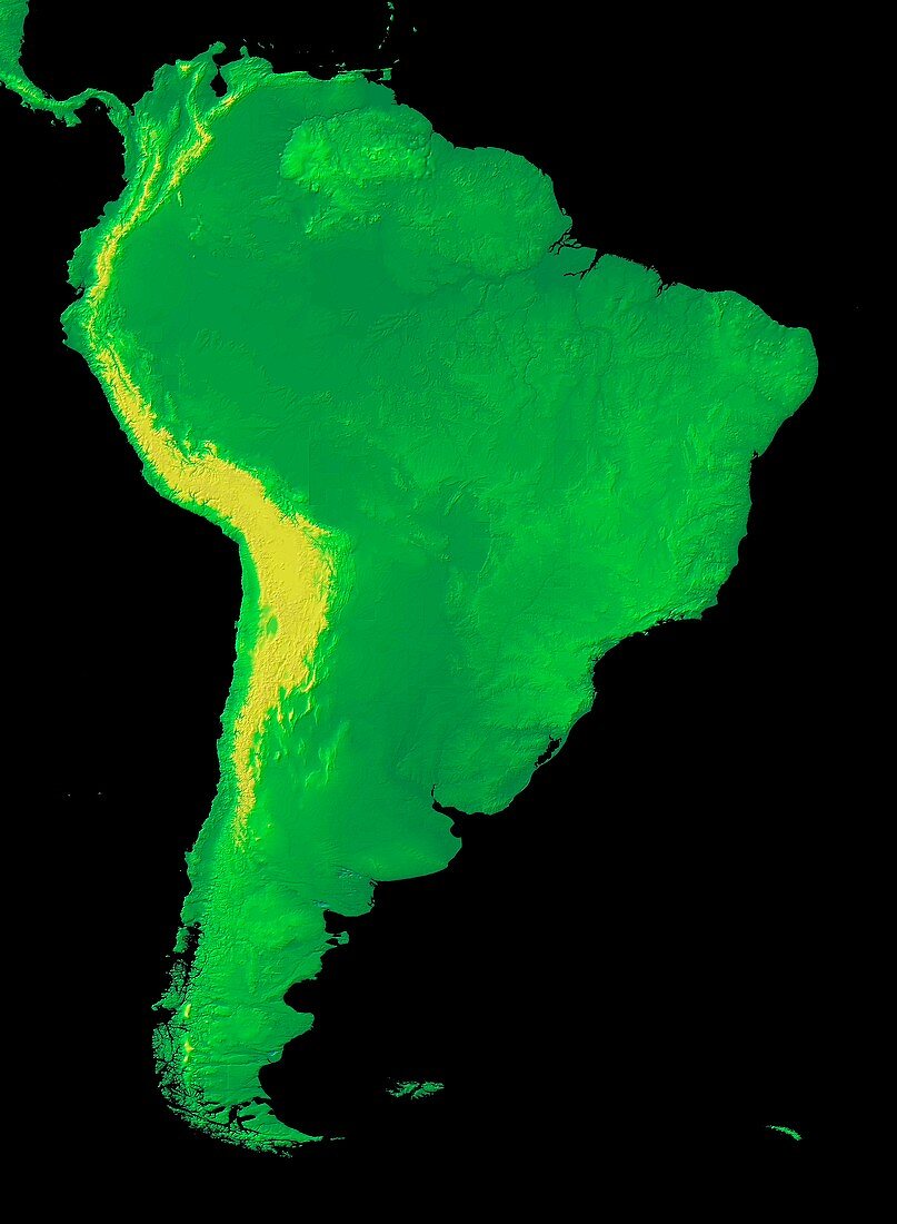
| South America, GLOBE map. Topographic map of the continent of South America, with colours on land indicating elevation above sea level. The colour-coding (low to high) ranges from green to yellow, with relief also shown. GLOBE (Global Land One-kilometer Base Elevation) is a global digital elevation model (DEM), produced by the National Geophysical Data Center (NGDC) of the National Oceanic and Atmospheric Administration (NOAA). It incorporates data from a range of different sources. Since 2015, GLOBE data has been collated and published by NOAA's National Centers for Environmental Information (NCEI). | |
| Lizenzart: | Lizenzpflichtig |
| Credit: | Science Photo Library / NOAA |
| Bildgröße: | 4544 px × 6196 px |
| Modell-Rechte: | nicht erforderlich |
| Eigentums-Rechte: | nicht erforderlich |
| Restrictions: |
|
Preise für dieses Bild ab 15 €
Universitäten & Organisationen
(Informationsmaterial Digital, Informationsmaterial Print, Lehrmaterial Digital etc.)
ab 15 €
Redaktionell
(Bücher, Bücher: Sach- und Fachliteratur, Digitale Medien (redaktionell) etc.)
ab 30 €
Werbung
(Anzeigen, Aussenwerbung, Digitale Medien, Fernsehwerbung, Karten, Werbemittel, Zeitschriften etc.)
ab 55 €
Handelsprodukte
(bedruckte Textilie, Kalender, Postkarte, Grußkarte, Verpackung etc.)
ab 75 €
Pauschalpreise
Rechtepakete für die unbeschränkte Bildnutzung in Print oder Online
ab 495 €