Topographic map of Mercury
Bildnummer 12334533
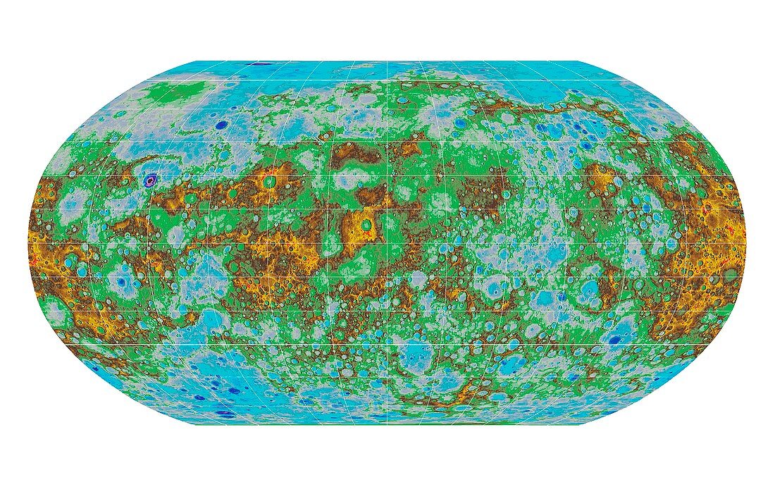
| Topographic map of Mercury. This digital elevation mapping (DEM) projection shows the features on the surface of Mercury, using data collated by USGS scientists. This view provides the first comprehensive view of Mercury's entire surface, illustrating the planet's craters, volcanoes and tectonic landforms. Mercury's surface is coloured according the topography of the surface, with regions with higher elevations coloured brown, yellow and red, and regions with lower elevations coloured blue and purple. Image published in 2016. | |
| Lizenzart: | Lizenzpflichtig |
| Credit: | Science Photo Library / US Geological Survey |
| Bildgröße: | 4134 px × 2598 px |
| Modell-Rechte: | nicht erforderlich |
| Eigentums-Rechte: | nicht erforderlich |
| Restrictions: | - |
Preise für dieses Bild ab 15 €
Universitäten & Organisationen
(Informationsmaterial Digital, Informationsmaterial Print, Lehrmaterial Digital etc.)
ab 15 €
Redaktionell
(Bücher, Bücher: Sach- und Fachliteratur, Digitale Medien (redaktionell) etc.)
ab 30 €
Werbung
(Anzeigen, Aussenwerbung, Digitale Medien, Fernsehwerbung, Karten, Werbemittel, Zeitschriften etc.)
ab 55 €
Handelsprodukte
(bedruckte Textilie, Kalender, Postkarte, Grußkarte, Verpackung etc.)
ab 75 €
Pauschalpreise
Rechtepakete für die unbeschränkte Bildnutzung in Print oder Online
ab 495 €
Keywords
- 2016,
- Astronomie,
- astronomisch,
- Astrophysik,
- astrophysikalisch,
- ausgeschnitten,
- Ausschnitte,
- Diagramm,
- digitale Höhenkarte,
- farbcodiert,
- Grafik,
- Karte,
- Krater,
- Merkur,
- NASA,
- Niemand,
- Oberfläche,
- Oval,
- Planet,
- Planetenwissenschaft,
- Projektion,
- Raum,
- Sonnensystem,
- topografisch,
- Topographie,
- usgs,
- Vulkane,
- vulkanisch