Arctic sea ice maximum, March 2017
Bildnummer 12325821
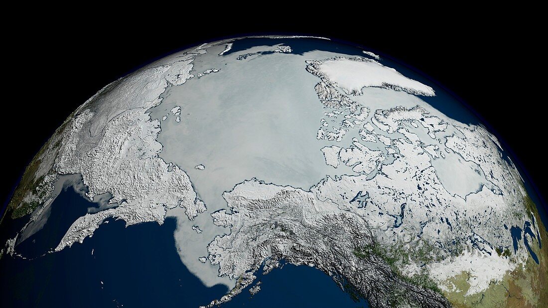
| Arctic sea ice maximum, March 2017, satellite image. This image, showing the Arctic above the Bering Strait (lower left) is based on satellite data. The Arctic sea ice (white) reaches a maximum in around March, at the end of the Arctic winter. This maximum extent for 2017 covered 14.42 million square kilometres. This maximum can be compared to the minimum reached later in the year in September. The Arctic's sea ice maximum extent has dropped by an average of 2.8 percent per decade since 1979. The sea ice data for this image, obtained on 7 March, is from the AMSR2 (Advanced Microwave Scanning Radiometer 2) sensor on the Japanese Shizuku satellite. | |
| Lizenzart: | Lizenzpflichtig |
| Credit: | Science Photo Library / NASA's Scientific Visualization Studio / NASA |
| Bildgröße: | 3942 px × 2218 px |
| Modell-Rechte: | nicht erforderlich |
| Eigentums-Rechte: | nicht erforderlich |
| Restrictions: | - |
Preise für dieses Bild ab 15 €
Universitäten & Organisationen
(Informationsmaterial Digital, Informationsmaterial Print, Lehrmaterial Digital etc.)
ab 15 €
Redaktionell
(Bücher, Bücher: Sach- und Fachliteratur, Digitale Medien (redaktionell) etc.)
ab 30 €
Werbung
(Anzeigen, Aussenwerbung, Digitale Medien, Fernsehwerbung, Karten, Werbemittel, Zeitschriften etc.)
ab 55 €
Handelsprodukte
(bedruckte Textilie, Kalender, Postkarte, Grußkarte, Verpackung etc.)
ab 75 €
Pauschalpreise
Rechtepakete für die unbeschränkte Bildnutzung in Print oder Online
ab 495 €
Keywords
- 2017,
- 21. Jahrhundert,
- Alaska,
- Arktis,
- Arktischer Ozean,
- Asiatisch,
- Asien,
- eisig,
- Erdbeobachtung,
- Erde,
- Eurasien,
- Eurasisch,
- Gefroren,
- gefrorenes Wasser,
- geografisch,
- Geographie,
- Glaziologie,
- Globale Erwärmung,
- Kalt,
- Karte,
- Klimatologie,
- klimatologisch,
- Klimawandel,
- maximal,
- Meereis,
- Mikrowelle,
- Modell-,
- nordamerikanisch,
- Planet,
- Raum,
- Russisch,
- Russland,
- Satellit,
- Satellitenbild,
- Sibirien,
- Sibirisch,
- Umwelt,
- Weltall,
- Winter