Mount St Helens, USA, satellite image
Bildnummer 12325553
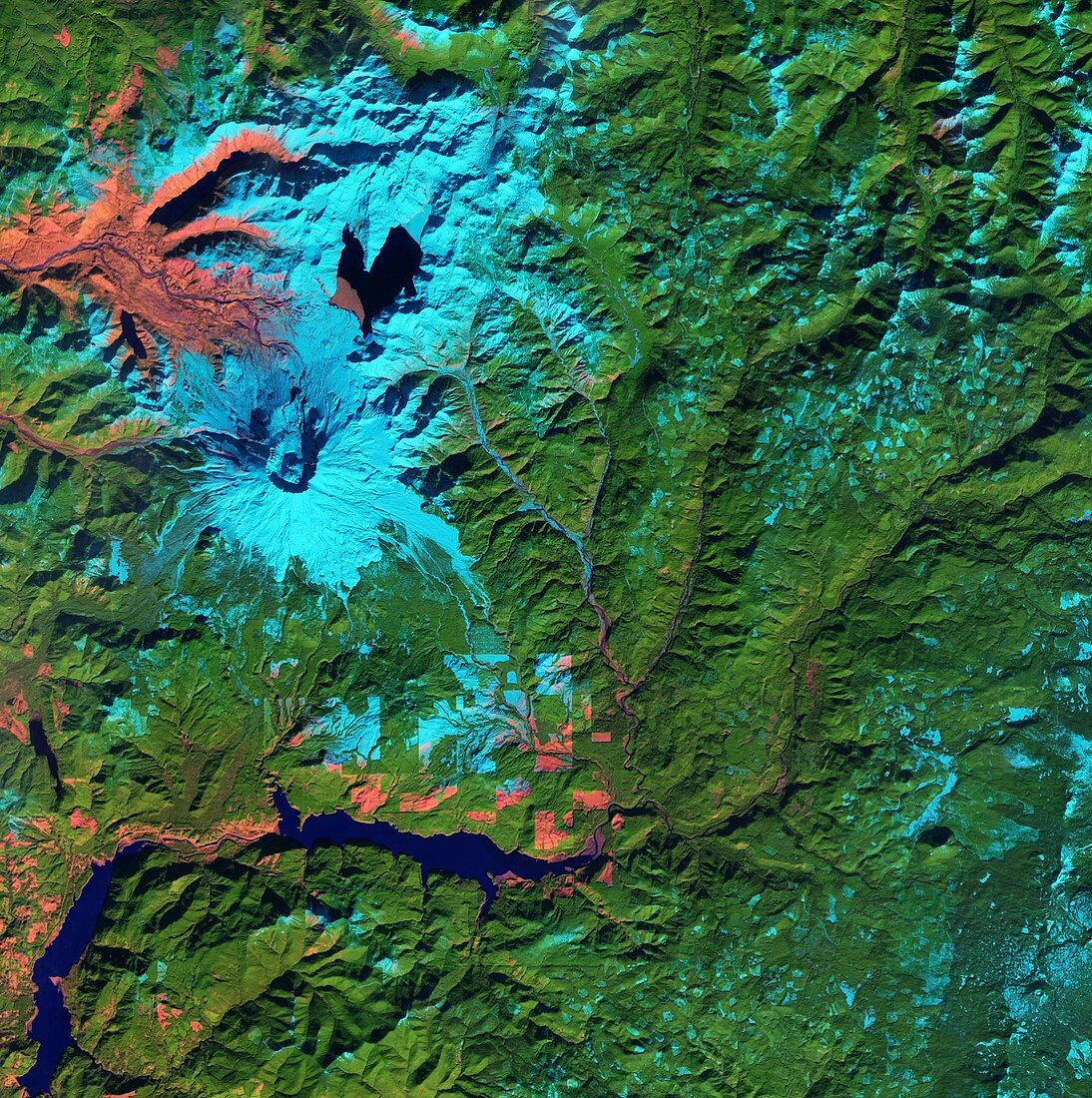
| Mount St Helens. Satellite image of Mount St Helens, Washington, USA. This active stratovolcano is located in the Cascade Range and is part of the Cascade Volcanic Arc, a segment of the Pacific Ring of Fire that includes over 160 active volcanoes in the Pacific Northwest of the USA. It is well-known for its ash explosions and pyroclastic flows and the major eruption of May 1980, the deadliest and most economically destructive volcanic event in the history of the US. Imaged by the Sentinel-2A satellite, on 22nd June 2015. | |
| Lizenzart: | Lizenzpflichtig |
| Credit: | Science Photo Library / ESA / Copernicus Sentinel data (2016) |
| Bildgröße: | 4559 px × 4583 px |
| Modell-Rechte: | nicht erforderlich |
| Eigentums-Rechte: | nicht erforderlich |
| Restrictions: |
|
Preise für dieses Bild ab 15 €
Universitäten & Organisationen
(Informationsmaterial Digital, Informationsmaterial Print, Lehrmaterial Digital etc.)
ab 15 €
Redaktionell
(Bücher, Bücher: Sach- und Fachliteratur, Digitale Medien (redaktionell) etc.)
ab 30 €
Werbung
(Anzeigen, Aussenwerbung, Digitale Medien, Fernsehwerbung, Karten, Werbemittel, Zeitschriften etc.)
ab 55 €
Handelsprodukte
(bedruckte Textilie, Kalender, Postkarte, Grußkarte, Verpackung etc.)
ab 75 €
Pauschalpreise
Rechtepakete für die unbeschränkte Bildnutzung in Print oder Online
ab 495 €
Keywords
- 2015,
- 21. Jahrhundert,
- aktiv,
- Berg,
- Berge,
- bergig,
- Erdbeobachtung,
- gebirgig,
- geografisch,
- Geographie,
- Geologie,
- geologisch,
- Niemand,
- Nordamerika,
- nordamerikanisch,
- pazifischer Feuerring,
- Pazifischer Nordwesten,
- Satellitenbild,
- Schnee,
- schneebedeckt,
- Stratovulkan,
- Umwelt,
- Umweltwissenschaften,
- uns,
- USA,
- Vereinigte Staaten,
- Vulkan,
- vulkanisch,
- Vulkanologie,
- Washington,
- Weltall