Section of Waldseemuller's Carta Marina, 1516
Bildnummer 12257767
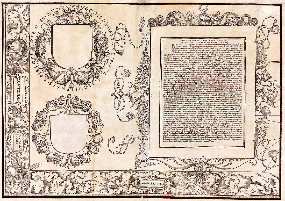
| Section of Waldseemuller's Carta Marina. This is the bottom left corner of the 1516 Carta Marina world map, produced by German cartographer Martin Waldseemuller (c.1470-1520). This section show a large text block and two shields. The shield at lower left has a sheet of paper covering a list of corrections. This map expanded upon Waldseemuller's earlier work of 1507. There are numerous illustrations of mythological creatures and travel stories. Text blocks (in Latin) describe different regions, and the border includes representations of the winds. The red grid lines were added by the map's owner, Johannes Schoner. For all 12 sections of this map, see images C032/2804 to C032/2815. For the map as a whole, see image C032/2803. | |
| Lizenzart: | Lizenzpflichtig |
| Credit: | Science Photo Library / LIBRARY OF CONGRESS, Geography and Map Division |
| Bildgröße: | 6113 px × 4311 px |
| Modell-Rechte: | nicht erforderlich |
| Eigentums-Rechte: | nicht erforderlich |
| Restrictions: | - |
Preise für dieses Bild ab 15 €
Universitäten & Organisationen
(Informationsmaterial Digital, Informationsmaterial Print, Lehrmaterial Digital etc.)
ab 15 €
Redaktionell
(Bücher, Bücher: Sach- und Fachliteratur, Digitale Medien (redaktionell) etc.)
ab 30 €
Werbung
(Anzeigen, Aussenwerbung, Digitale Medien, Fernsehwerbung, Karten, Werbemittel, Zeitschriften etc.)
ab 55 €
Handelsprodukte
(bedruckte Textilie, Kalender, Postkarte, Grußkarte, Verpackung etc.)
ab 75 €
Pauschalpreise
Rechtepakete für die unbeschränkte Bildnutzung in Print oder Online
ab 495 €