Field geologist using hand-held GPS receiver
Bildnummer 12073170
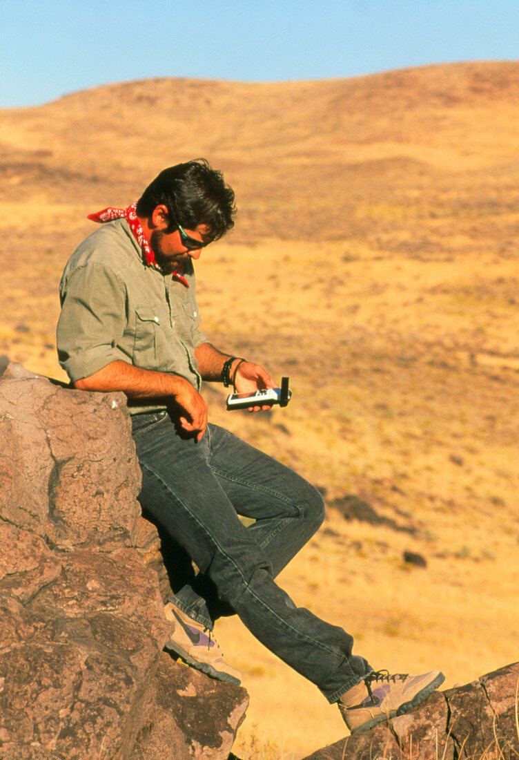
| MODEL RELEASED: Satellite navigation. Field geologist checking his location with a hand-held Garmin 45 global positioning system (GPS) receiver. The system uses signals sent by the network of 21 'Navstar' GPS satellites. Each satellite sends out a signal with its identity,position and the exact time from an atomic clock. The receiver reads these data and can instantly calculate its position anywhere in the world to within 100 metres. This is one of the new generation of GPS receivers which are portable and affordable. In addition to geologists GPS has benefits for hikers and climbers,sailing enthusiasts,private pilots and vehicle drivers | |
| Lizenzart: | Lizenzpflichtig |
| Credit: | Science Photo Library / KEN M. JOHNS |
| Bildgröße: | 2480 px × 3629 px |
| Modell-Rechte: | vorhanden |
| Eigentums-Rechte: | nicht erforderlich |
| Restrictions: |
|
Preise für dieses Bild ab 15 €
Universitäten & Organisationen
(Informationsmaterial Digital, Informationsmaterial Print, Lehrmaterial Digital etc.)
ab 15 €
Redaktionell
(Bücher, Bücher: Sach- und Fachliteratur, Digitale Medien (redaktionell) etc.)
ab 30 €
Werbung
(Anzeigen, Aussenwerbung, Digitale Medien, Fernsehwerbung, Karten, Werbemittel, Zeitschriften etc.)
ab 55 €
Handelsprodukte
(bedruckte Textilie, Kalender, Postkarte, Grußkarte, Verpackung etc.)
ab 75 €
Pauschalpreise
Rechtepakete für die unbeschränkte Bildnutzung in Print oder Online
ab 495 €