North America
Bildnummer 12056813
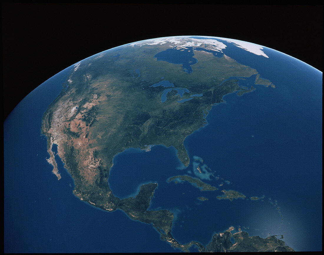
| North and Central America. Cloudless true-colour satellite image of North and Central America with the islands of the Carribean Sea. At top centre is Hudson Bay. Below this are the 5 Great Lakes; from left to right they are Lakes Superior,Michigan,Huron,Erie and Ontario. At centre left are deserts and the Rocky Mountains (dark). The four large islands in the Carribean (at lower centre) are from left to right: Cuba,Jamaica,Haiti/Dominican Republic and Puerto Rico. Image taken from 80 degrees west on an equatorial orbit at an altitude of 36,000 kilometres | |
| Lizenzart: | Lizenzpflichtig |
| Credit: | Science Photo Library / Ligon, Thomas |
| Bildgröße: | 4334 px × 3417 px |
| Modell-Rechte: | nicht erforderlich |
| Eigentums-Rechte: | nicht erforderlich |
| Restrictions: |
|
Preise für dieses Bild ab 15 €
Universitäten & Organisationen
(Informationsmaterial Digital, Informationsmaterial Print, Lehrmaterial Digital etc.)
ab 15 €
Redaktionell
(Bücher, Bücher: Sach- und Fachliteratur, Digitale Medien (redaktionell) etc.)
ab 30 €
Werbung
(Anzeigen, Aussenwerbung, Digitale Medien, Fernsehwerbung, Karten, Werbemittel, Zeitschriften etc.)
ab 55 €
Handelsprodukte
(bedruckte Textilie, Kalender, Postkarte, Grußkarte, Verpackung etc.)
ab 75 €
Pauschalpreise
Rechtepakete für die unbeschränkte Bildnutzung in Print oder Online
ab 495 €