Polar Vortex Causes Winter Warming
Bildnummer 12048909
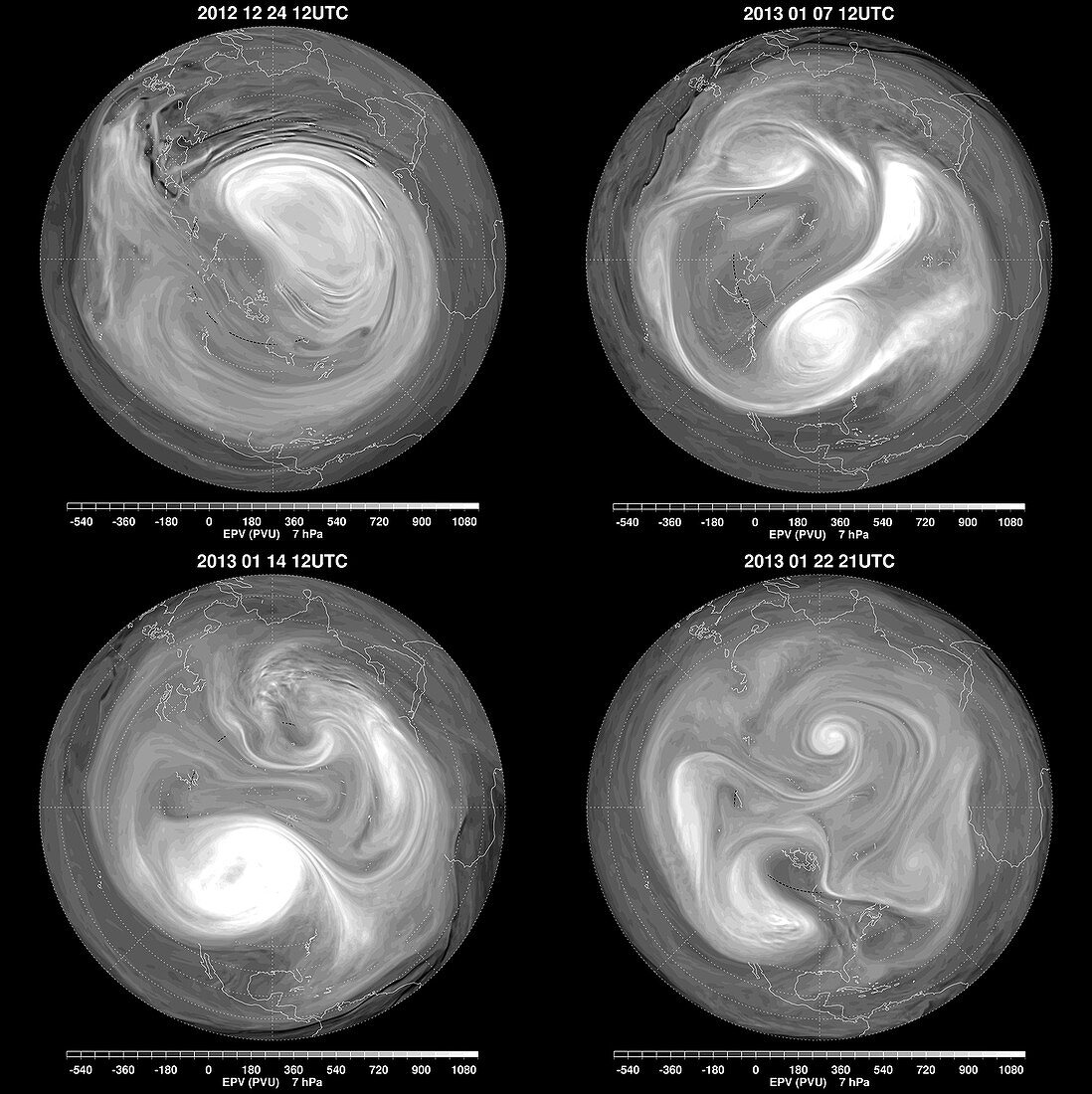
| Stratospheric sudden warmings (SSW) are a ubiquitous feature of the wintertime flow in the northern hemisphere. These events take their name from a rapid temperature increase of several tens of Kelvin over a few days in the high northern latitudes. These images from December 24,2012 through January 22,2013 are data models from NASA's Goddard Earth Observing System Model,Version 5 (GEOS-5) showing Ertel's Potential Vorticity (EPV) in potential vorticity units (PVU). The shading shows regions of high EPV,typical of the polar vortex,in white,and regions of low EPV,typical of tropical air masses,in darker shades. In the first image (top left) the deep-white regions represent high EPV and depict a strong,elongated polar vortex over northern Europe and Asia,with a tail of air adverted from the main vortex,which wrapped around the northern latitudes and circumscribed the pole. Over the next few days,the GEOS-5 analyses showed the vortex | |
| Lizenzart: | Lizenzpflichtig |
| Credit: | Science Photo Library / Global Modeling and Assimilation Office / NASA GSFC |
| Bildgröße: | 1792 px × 1796 px |
| Modell-Rechte: | nicht erforderlich |
| Eigentums-Rechte: | nicht erforderlich |
| Restrictions: |
|
Preise für dieses Bild ab 15 €
Universitäten & Organisationen
(Informationsmaterial Digital, Informationsmaterial Print, Lehrmaterial Digital etc.)
ab 15 €
Redaktionell
(Bücher, Bücher: Sach- und Fachliteratur, Digitale Medien (redaktionell) etc.)
ab 30 €
Werbung
(Anzeigen, Aussenwerbung, Digitale Medien, Fernsehwerbung, Karten, Werbemittel, Zeitschriften etc.)
ab 55 €
Handelsprodukte
(bedruckte Textilie, Kalender, Postkarte, Grußkarte, Verpackung etc.)
ab 75 €
Pauschalpreise
Rechtepakete für die unbeschränkte Bildnutzung in Print oder Online
ab 495 €