Hurricane Sandy from Above
Bildnummer 12035260
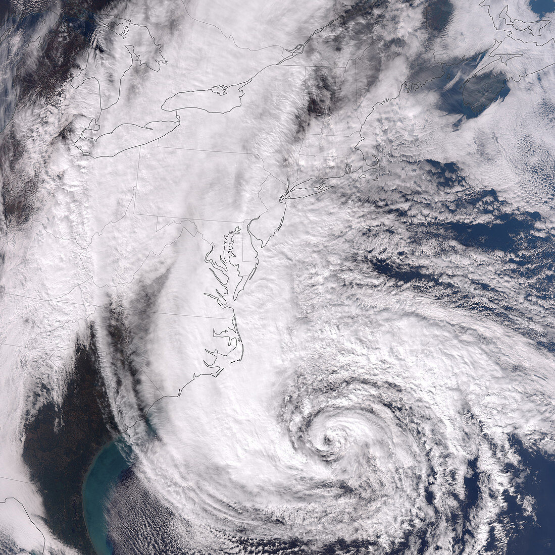
| Hurricane Sandy from above. Shortly after this image was captured,the U.S. National Hurricane Center reported that Sandy's center was located about 575 miles (930 kilometres) south of New York City. Maximum sustained winds were observed at 75 miles (120 kilometres) per hour,and the barometric pressure at the center of the storm was 951 millibars (28.08 inches). Landfall was predicted for the superstorm in New Jersey on October 29,midway between Philadelphia and New York City. The Visible Infrared Imaging Radiometer Suite (VIIRS) on the Suomi NPP satellite acquired this image of Hurricane Sandy at 1:50 p.m. Eastern Daylight Time on October 28,2012 | |
| Lizenzart: | Lizenzpflichtig |
| Credit: | Science Photo Library / Allen, Jesse / NASA Earth Observatory |
| Bildgröße: | 5427 px × 5433 px |
| Modell-Rechte: | nicht erforderlich |
| Eigentums-Rechte: | nicht erforderlich |
| Restrictions: |
|
Preise für dieses Bild ab 15 €
Universitäten & Organisationen
(Informationsmaterial Digital, Informationsmaterial Print, Lehrmaterial Digital etc.)
ab 15 €
Redaktionell
(Bücher, Bücher: Sach- und Fachliteratur, Digitale Medien (redaktionell) etc.)
ab 30 €
Werbung
(Anzeigen, Aussenwerbung, Digitale Medien, Fernsehwerbung, Karten, Werbemittel, Zeitschriften etc.)
ab 55 €
Handelsprodukte
(bedruckte Textilie, Kalender, Postkarte, Grußkarte, Verpackung etc.)
ab 75 €
Pauschalpreise
Rechtepakete für die unbeschränkte Bildnutzung in Print oder Online
ab 495 €
Keywords
- 2012,
- Auge,
- Erdbeobachtung,
- Hurrikan,
- Hurrikan Sandy,
- Klimatologie,
- Land,
- Meteorologie,
- meteorologisch,
- Naturkatastrophe,
- New York,
- New York City,
- Nordamerika,
- NY,
- NYC,
- sandig,
- Satellitenbild,
- Spiral,
- Spirale,
- spiralförmig,
- Sturm,
- Tropensturm,
- viirs,
- Wetter,
- Wind,
- Windig,
- Wissenschaft,
- Wolke,
- Wolken,
- Zyklon