Northern hemisphere sky map,1603
Bildnummer 11905249
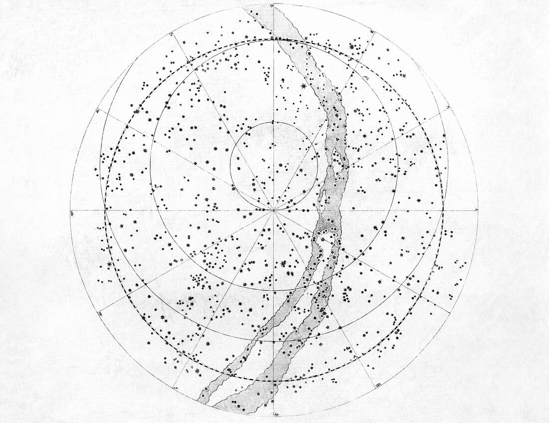
| Northern hemisphere sky map. 17th century artwork of the night sky as seen from Earth's northern hemisphere,showing star constellations and their coordinates. This planisphere is from Johann Bayer's Uranometria (Greek for 'sky measurements'),a star atlas and catalogue that contains a total of 51 stellar maps. The book,published in 1603,was the first of its kind since it portrayed the constellations as maps rather than as mythological pictures. Each engraving has a reference grid so that the stars' positions in the sky can be precisely determined | |
| Lizenzart: | Lizenzpflichtig |
| Credit: | Science Photo Library / Royal Astronomical Society |
| Bildgröße: | 4961 px × 3826 px |
| Modell-Rechte: | nicht erforderlich |
| Eigentums-Rechte: | nicht erforderlich |
| Restrictions: | - |
Preise für dieses Bild ab 15 €
Universitäten & Organisationen
(Informationsmaterial Digital, Informationsmaterial Print, Lehrmaterial Digital etc.)
ab 15 €
Redaktionell
(Bücher, Bücher: Sach- und Fachliteratur, Digitale Medien (redaktionell) etc.)
ab 30 €
Werbung
(Anzeigen, Aussenwerbung, Digitale Medien, Fernsehwerbung, Karten, Werbemittel, Zeitschriften etc.)
ab 55 €
Handelsprodukte
(bedruckte Textilie, Kalender, Postkarte, Grußkarte, Verpackung etc.)
ab 75 €
Pauschalpreise
Rechtepakete für die unbeschränkte Bildnutzung in Print oder Online
ab 495 €
Keywords
- abgebildet,
- Astronomie,
- astronomisch,
- Atlas,
- Diagramm,
- Einfarbig,
- Führer,
- Geschichte,
- Geschichte der Wissenschaft,
- Gitter,
- Graviert,
- Gravur,
- Himmel,
- Himmelskörper,
- Himmelskugel,
- historisch,
- Illustration,
- Johann Bayer,
- Johannes Bayer,
- Karte,
- Katalog,
- Konstellation,
- Kreis,
- kreisförmig,
- Kunstwerk,
- mehrere,
- Mythologie,
- Norden,
- Raum,
- rund,
- Schwarz und weiß,
- Stern,
- Sternbilder,
- Sterne,
- Teller,
- viele