Global positioning system
Bildnummer 11897145
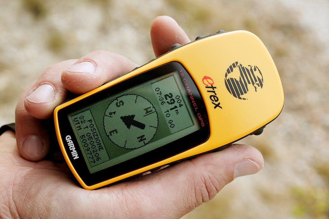
| Global positioning system (GPS) receiver in use. The display panel shows a compass pointer pointing towards a known location. 24 GPS satellites trace precision orbits around the Earth. Each satellite transmits radio signals that can be detected by this receiver. Three signals allow calculation of latitude and longitude. A fourth signal allows altitude calculations. Transmission of time data allows the calculation of local time | |
| Lizenzart: | Lizenzpflichtig |
| Credit: | Science Photo Library / Fermariello, Mauro |
| Bildgröße: | 4064 px × 2704 px |
| Modell-Rechte: | nicht erforderlich |
| Eigentums-Rechte: | nicht erforderlich |
| Restrictions: | - |
Preise für dieses Bild ab 15 €
Universitäten & Organisationen
(Informationsmaterial Digital, Informationsmaterial Print, Lehrmaterial Digital etc.)
ab 15 €
Redaktionell
(Bücher, Bücher: Sach- und Fachliteratur, Digitale Medien (redaktionell) etc.)
ab 30 €
Werbung
(Anzeigen, Aussenwerbung, Digitale Medien, Fernsehwerbung, Karten, Werbemittel, Zeitschriften etc.)
ab 55 €
Handelsprodukte
(bedruckte Textilie, Kalender, Postkarte, Grußkarte, Verpackung etc.)
ab 75 €
Pauschalpreise
Rechtepakete für die unbeschränkte Bildnutzung in Print oder Online
ab 495 €