GPS receiver
Bildnummer 11897127
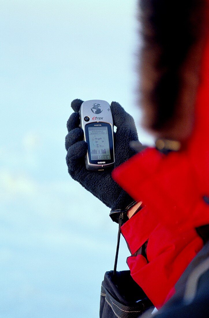
| Global positioning system (GPS) receiver held in a hand. 24 GPS satellites trace precision orbits around the Earth. Each satellite transmits radio signals that can be detected by this receiver. Three signals allow calculation of latitude and longitude. A fourth signal allows altitude calculations. Transmission of time data allows the calculation of local time. This is a Garmin eTrex GPS receiver that is receiving signals from eight GPS satellites and giving a location in the far north and west of Canada,just within the Arctic Circle | |
| Lizenzart: | Lizenzpflichtig |
| Credit: | Science Photo Library / Riedl, Martin |
| Bildgröße: | 3100 px × 4709 px |
| Modell-Rechte: | nicht erforderlich |
| Eigentums-Rechte: | nicht erforderlich |
| Restrictions: | - |
Preise für dieses Bild ab 15 €
Universitäten & Organisationen
(Informationsmaterial Digital, Informationsmaterial Print, Lehrmaterial Digital etc.)
ab 15 €
Redaktionell
(Bücher, Bücher: Sach- und Fachliteratur, Digitale Medien (redaktionell) etc.)
ab 30 €
Werbung
(Anzeigen, Aussenwerbung, Digitale Medien, Fernsehwerbung, Karten, Werbemittel, Zeitschriften etc.)
ab 55 €
Handelsprodukte
(bedruckte Textilie, Kalender, Postkarte, Grußkarte, Verpackung etc.)
ab 75 €
Pauschalpreise
Rechtepakete für die unbeschränkte Bildnutzung in Print oder Online
ab 495 €
Keywords
- 1,
- Arktis,
- einfrieren,
- Eis,
- Elektronik,
- elektronisch,
- Erkundung,
- eTrex,
- fern,
- Forscher,
- Garmin,
- Gefroren,
- Gerät,
- Hand,
- Kalt,
- Kanada,
- Kanadisch,
- Kommunikation,
- Navigation,
- Ort,
- polar,
- Satellit,
- Schnee,
- Technologie,
- technologisch,
- Telekommunikation,
- Tragbar,
- Wildnis