Soldiers using global positioning system
Bildnummer 11897126
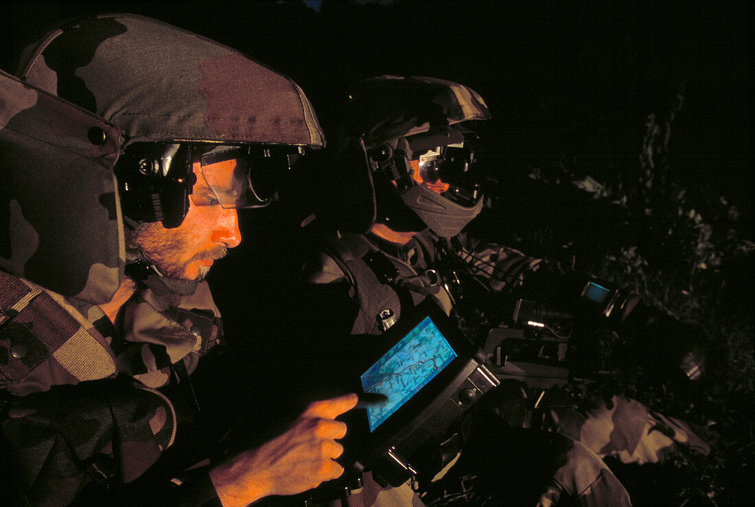
| Soldiers using global positioning system (GPS) equipment. GPS relies on a network of 24 US military satellites. By detecting signals broadcast from the satellites,GPS receivers can calculate their current latitude and longitude to a high degree of precision (within 10 to 20 metres). Altitude can also be determined. The system is available for use by civilians. These soldiers are testing the French FELIN infantry system,which integrates navigation,communication,targetting and sensor systems. Deployment of FELIN is planned for 2006 | |
| Lizenzart: | Lizenzpflichtig |
| Credit: | Science Photo Library / Psaila, Philippe |
| Bildgröße: | 4575 px × 3072 px |
| Modell-Rechte: | Derzeit liegt noch kein Release vor. Bitte kontaktieren Sie uns vor Verwendung. |
| Eigentums-Rechte: | nicht erforderlich |
| Restrictions: | - |
Preise für dieses Bild ab 15 €
Universitäten & Organisationen
(Informationsmaterial Digital, Informationsmaterial Print, Lehrmaterial Digital etc.)
ab 15 €
Redaktionell
(Bücher, Bücher: Sach- und Fachliteratur, Digitale Medien (redaktionell) etc.)
ab 30 €
Werbung
(Anzeigen, Aussenwerbung, Digitale Medien, Fernsehwerbung, Karten, Werbemittel, Zeitschriften etc.)
ab 55 €
Handelsprodukte
(bedruckte Textilie, Kalender, Postkarte, Grußkarte, Verpackung etc.)
ab 75 €
Pauschalpreise
Rechtepakete für die unbeschränkte Bildnutzung in Print oder Online
ab 495 €