Artwork of Global Positioning Satellite orbits
Bildnummer 11889185
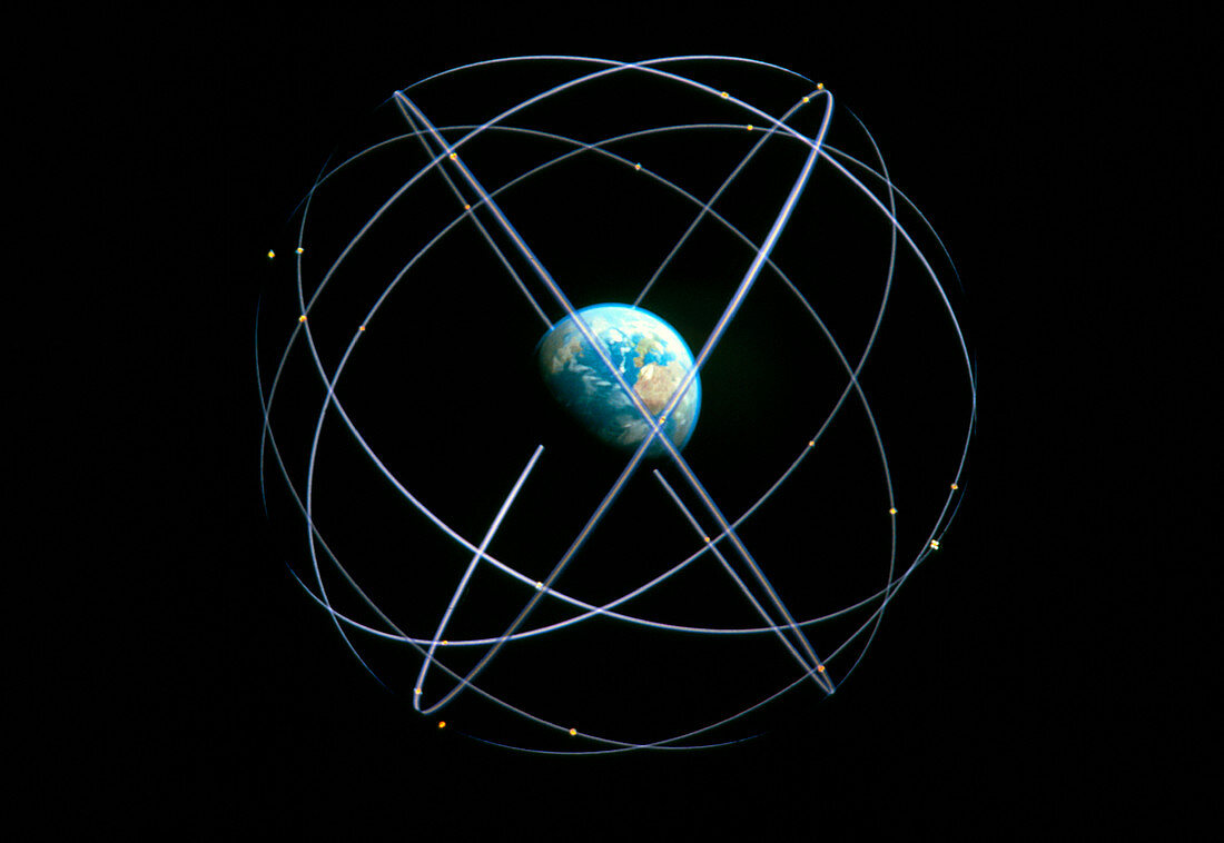
| Global Positioning System. Artwork of the orbits of the Navstar satellites used in the Global Positioning System (GPS). The GPS system uses a constellation of 24 operational Navstar satellites in 6 orbital planes,ensuring that 3-6 satellites are above the horizon at any location at any one time. Small ground-based receivers calculate the user's position by measuring the time it takes for signals to arrive from the satellites. Military receivers have an accuracy of a few metres,whilst the degraded signals intended for civilian use give an accuracy of less than 100 metres | |
| Lizenzart: | Lizenzpflichtig |
| Credit: | Science Photo Library / EUROCONTROL / CE / ESA |
| Bildgröße: | 3598 px × 2480 px |
| Modell-Rechte: | nicht erforderlich |
| Eigentums-Rechte: | nicht erforderlich |
| Restrictions: |
|
Preise für dieses Bild ab 15 €
Universitäten & Organisationen
(Informationsmaterial Digital, Informationsmaterial Print, Lehrmaterial Digital etc.)
ab 15 €
Redaktionell
(Bücher, Bücher: Sach- und Fachliteratur, Digitale Medien (redaktionell) etc.)
ab 30 €
Werbung
(Anzeigen, Aussenwerbung, Digitale Medien, Fernsehwerbung, Karten, Werbemittel, Zeitschriften etc.)
ab 55 €
Handelsprodukte
(bedruckte Textilie, Kalender, Postkarte, Grußkarte, Verpackung etc.)
ab 75 €
Pauschalpreise
Rechtepakete für die unbeschränkte Bildnutzung in Print oder Online
ab 495 €