GOES-12 environmental satellite
Bildnummer 11889169
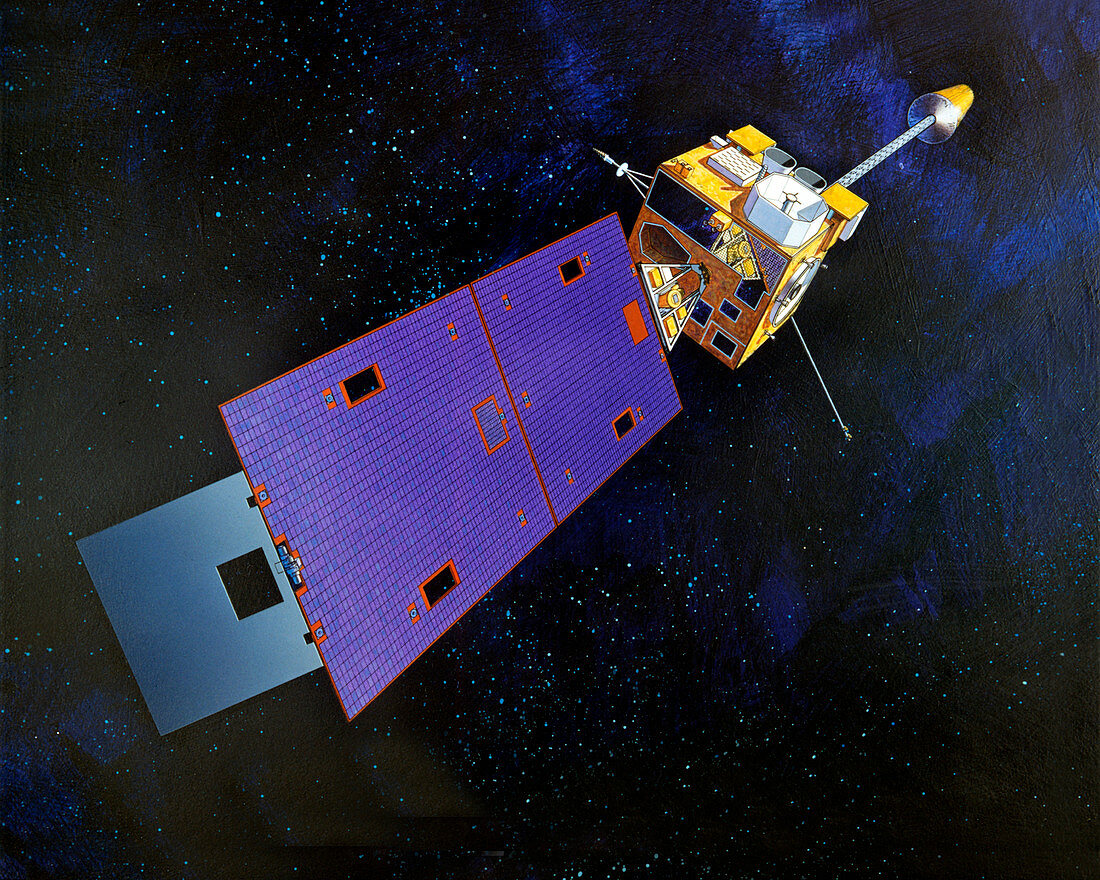
| GOES-12 environmental satellite. Artwork showing the Geostationary Operational Environmental Satellite (GOES)-12. This satellite carries instruments to monitor weather conditions which aid the forecasting of hurricanes and severe storms. It also has a Solar X-ray Imager to detect storms on the surface of the Sun,which can influence the weather on Earth. The satellite has been in geostationary orbit 36,000 kilometres above the Equator since its launch on 22nd July 2001 from Cape Canaveral,Florida,USA | |
| Lizenzart: | Lizenzpflichtig |
| Credit: | Science Photo Library / NASA / GSFC |
| Bildgröße: | 3000 px × 2400 px |
| Modell-Rechte: | nicht erforderlich |
| Eigentums-Rechte: | nicht erforderlich |
| Restrictions: | - |
Preise für dieses Bild ab 15 €
Universitäten & Organisationen
(Informationsmaterial Digital, Informationsmaterial Print, Lehrmaterial Digital etc.)
ab 15 €
Redaktionell
(Bücher, Bücher: Sach- und Fachliteratur, Digitale Medien (redaktionell) etc.)
ab 30 €
Werbung
(Anzeigen, Aussenwerbung, Digitale Medien, Fernsehwerbung, Karten, Werbemittel, Zeitschriften etc.)
ab 55 €
Handelsprodukte
(bedruckte Textilie, Kalender, Postkarte, Grußkarte, Verpackung etc.)
ab 75 €
Pauschalpreise
Rechtepakete für die unbeschränkte Bildnutzung in Print oder Online
ab 495 €
Keywords
- 21. Jahrhundert,
- Amerikanisch,
- Erdbeobachtung,
- geografisch,
- Geographie,
- Hurrikan,
- Illustration,
- Kunstwerk,
- Meteorologie,
- meteorologisch,
- Monitor,
- Orbit,
- Raum,
- Satellit,
- Solar,
- Sturm,
- Stürme,
- Technologie,
- technologisch,
- Überwachung,
- umkreisend,
- Umwelt,
- uns,
- USA,
- Vereinigte Staaten,
- Weltraumflug,
- Wetter