View of landslides in the Valles Marineris,Mars
Bildnummer 11882230
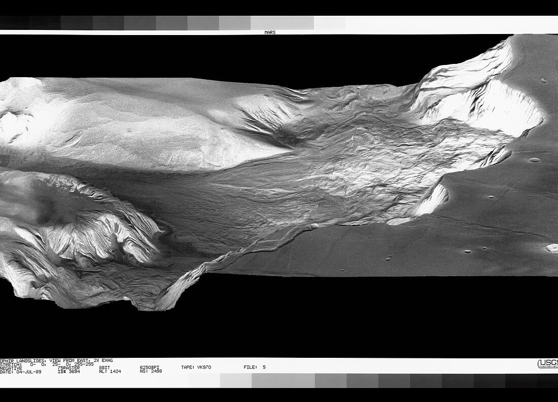
| Oblique view of landslides in Ophir Chasm,Mars,computer-processed from Viking spacecraft imagery & topographic maps of the planet. Ophir Chasm lies in the central region of the giant Martian canyon system the Valles Marineris. The canyons were formed by a combination of geological faulting,landslides,& erosion by wind & water. The three arc-shaped cliffs at right are slump scarps and the landslide debris is piled at the base of the cliffs. The scarps are each about 25 km wide and 4 km high and the landslide debris has flowed a distance of about 65 km from the cliff base. The vertical scale of the image has been stretched by a factor of 2,exaggerating the cliff heights. (Image processing by Alfred McEwen & topographic mapping by Sherman Wu,both at USGS,Flagstaff | |
| Lizenzart: | Lizenzpflichtig |
| Credit: | Science Photo Library / US Geological Survey |
| Bildgröße: | 3466 px × 2497 px |
| Modell-Rechte: | nicht erforderlich |
| Eigentums-Rechte: | nicht erforderlich |
| Restrictions: | - |
Preise für dieses Bild ab 15 €
Universitäten & Organisationen
(Informationsmaterial Digital, Informationsmaterial Print, Lehrmaterial Digital etc.)
ab 15 €
Redaktionell
(Bücher, Bücher: Sach- und Fachliteratur, Digitale Medien (redaktionell) etc.)
ab 30 €
Werbung
(Anzeigen, Aussenwerbung, Digitale Medien, Fernsehwerbung, Karten, Werbemittel, Zeitschriften etc.)
ab 55 €
Handelsprodukte
(bedruckte Textilie, Kalender, Postkarte, Grußkarte, Verpackung etc.)
ab 75 €
Pauschalpreise
Rechtepakete für die unbeschränkte Bildnutzung in Print oder Online
ab 495 €