Bucharest,Romania
Bildnummer 11748822
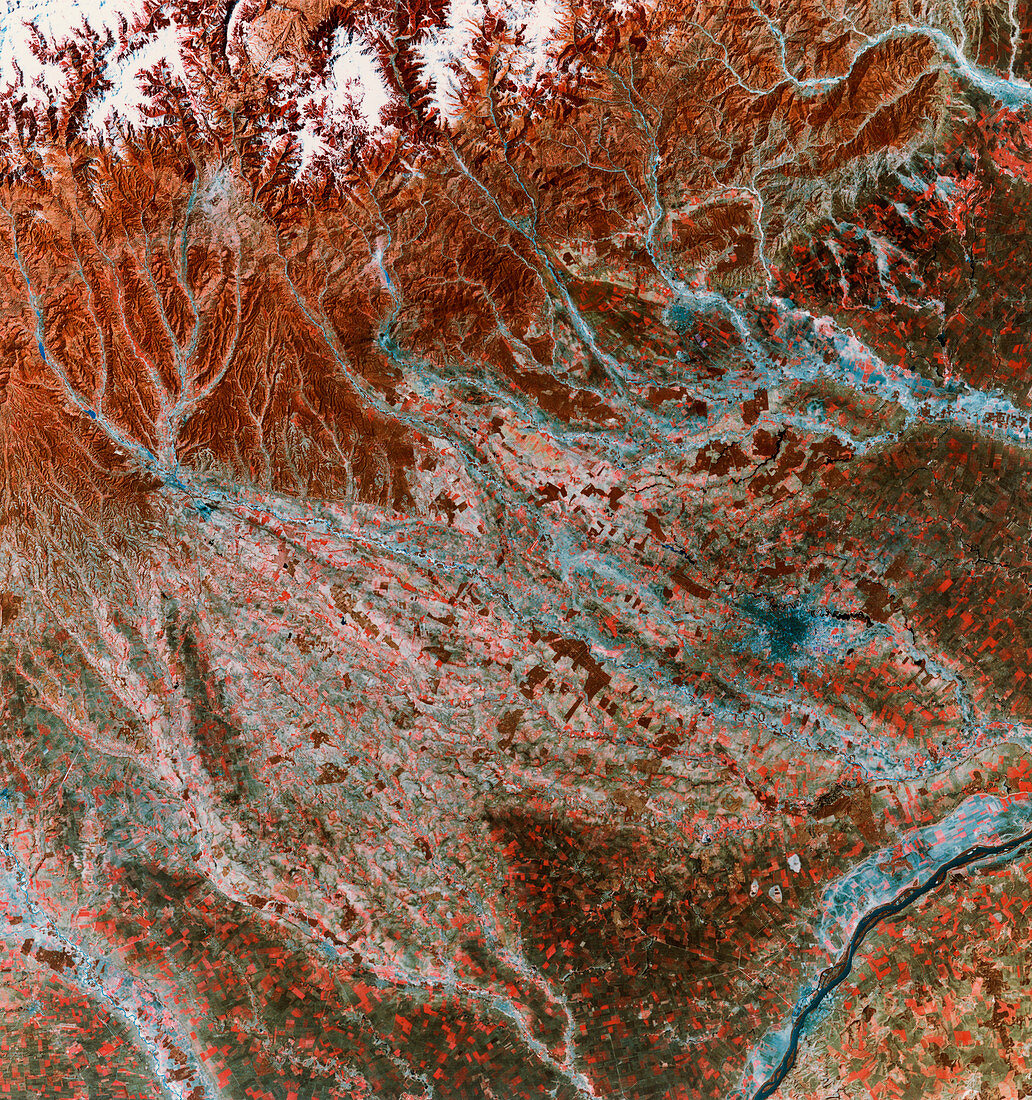
| Bucharest,Romania,infrared satellite image. North is at top. The city of Bucharest is at centre right (blue). Barren or sparsely vegetated land is brown,agricultural land is green/red and water is dark blue. At top left are the snow- covered mountains of the Transylvanian Alps. The River Danube (bottom right) forms the border between Romania and Bulgaria. Between the Alps and the Danube are lowlands that are predominantly used for grain cultivation. This 185- kilometre- wide image was taken on 04 April 1976,in visible and infrared wavelengths,with the Multispectral Scanner (MSS) sensor on a NASA Landsat satellite | |
| Lizenzart: | Lizenzpflichtig |
| Credit: | Science Photo Library / MDA Information Systems |
| Bildgröße: | 4050 px × 4316 px |
| Modell-Rechte: | nicht erforderlich |
| Eigentums-Rechte: | nicht erforderlich |
| Restrictions: | - |
Preise für dieses Bild ab 15 €
Universitäten & Organisationen
(Informationsmaterial Digital, Informationsmaterial Print, Lehrmaterial Digital etc.)
ab 15 €
Redaktionell
(Bücher, Bücher: Sach- und Fachliteratur, Digitale Medien (redaktionell) etc.)
ab 30 €
Werbung
(Anzeigen, Aussenwerbung, Digitale Medien, Fernsehwerbung, Karten, Werbemittel, Zeitschriften etc.)
ab 55 €
Handelsprodukte
(bedruckte Textilie, Kalender, Postkarte, Grußkarte, Verpackung etc.)
ab 75 €
Pauschalpreise
Rechtepakete für die unbeschränkte Bildnutzung in Print oder Online
ab 495 €
Keywords
- Anbau,
- April,
- Bauernhöfe,
- Berg,
- Berge,
- Bodennutzung,
- Bulgarien,
- Erdbeobachtung,
- Europa,
- europäisch,
- Felder,
- Flüsse,
- geografisch,
- Geographie,
- Grenzen,
- Hauptstadt,
- infrarot,
- ir,
- kultiviert,
- Landwirtschaft,
- landwirtschaftlich,
- montan,
- mss,
- Rand,
- Rumänien,
- Rumänisch,
- Satellit,
- Stadt,
- Städte,
- städtisch,
- Urbanisierung,
- Wasser,
- Weltall