Kamchatka Peninsula
Bildnummer 11746466
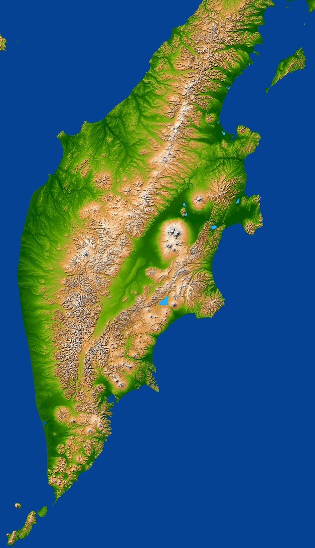
| Kamchatka Peninsula. Coloured three-dimensional computer map of the Kamchatka Peninsula,north- eastern Russia. North is at top. The peninsula,bordered by the Sea of Okhotsk (left) and the Bering Sea (right),extends over 1200 kilometres from the mainland,with an area of about 518,000 square kilometres. The main mountain range (centre) is the Sredinnyy Khrebet,which reaches heights of 3500 metres. The topography of the peninsula was mapped by the Shuttle Radar Topography Mission (SRTM) on the Space Shuttle Endeavour,in February 2000. Colour-coding reveals elevation: green is lowest,rising through yellow,brown to white,the highest | |
| Lizenzart: | Lizenzpflichtig |
| Credit: | Science Photo Library / NASA |
| Bildgröße: | 3500 px × 6092 px |
| Modell-Rechte: | nicht erforderlich |
| Eigentums-Rechte: | nicht erforderlich |
| Restrictions: | - |
Preise für dieses Bild ab 15 €
Universitäten & Organisationen
(Informationsmaterial Digital, Informationsmaterial Print, Lehrmaterial Digital etc.)
ab 15 €
Redaktionell
(Bücher, Bücher: Sach- und Fachliteratur, Digitale Medien (redaktionell) etc.)
ab 30 €
Werbung
(Anzeigen, Aussenwerbung, Digitale Medien, Fernsehwerbung, Karten, Werbemittel, Zeitschriften etc.)
ab 55 €
Handelsprodukte
(bedruckte Textilie, Kalender, Postkarte, Grußkarte, Verpackung etc.)
ab 75 €
Pauschalpreise
Rechtepakete für die unbeschränkte Bildnutzung in Print oder Online
ab 495 €
Keywords
- 3-d,
- abgebildet,
- Asiatisch,
- Asien,
- Berg,
- Berge,
- Dreidimensional,
- Geographie,
- Geologie,
- geologisch,
- Karte,
- Karten,
- Küste,
- Küsten,
- Küsten-,
- Land,
- Meer,
- Mission,
- Ozean,
- Ozeane,
- Pazifik,
- Reichweite,
- Russisch,
- Russland,
- Spektrometer,
- Terrain,
- topografisch,
- Umwelt,
- Vulkan,
- Vulkane,
- vulkanisch,
- Wasser,
- Weltall